4

How am I supposed to add a feature of a given length and/or at a given distance from another point?

In QGIS 3.4 I've used the Measure tool to mark the length then switched to "Add Feature". But in 3.22 switching to another tool removes Measure trace and I don't see a setting to switch back to the old behaviour. Drawing lines with style "marker line" and placing markers every N "meters at scale" does no good, they seem to be placed in projection units and not in actual meters. The same is true for the "Advanced Digitizing" toolbar which seems to be the usual recommendation in these cases. (And I would strongly prefer not to switch between several different projections depending on where I'm trying to draw something since there can be no projection preserving length everywhere on Earth.)

The best option I see is to use Measure, then remember the endpoint, draw an annotation line to that point and use the annotation layer the same way I used Measure before. But I would expect there's a more convenient way to achieve the same result.

6
  • do you have a direction?
    – Taras
    Commented Mar 20, 2022 at 14:06
  • @Taras Seeing a marker or something "5 km from point A in the direction towards point B" when drawing a line would be helpful enough. Commented Mar 20, 2022 at 14:10
  • You can use the following expression make_line($geometry, translate($geometry, 100, 100)) in the "Geometry by expression" geoalgorithm.
    – Taras
    Commented Mar 20, 2022 at 14:11
  • Can you please share your data with us? Can you please show what your points look like?
    – Taras
    Commented Mar 20, 2022 at 14:12
  • @Taras I don't see how this helps. To rephrase my question, I want a way to draw polylines that represent routes like "~10 km from this point down this river". For that, I need a visual reminder how long 10 km is, like what Measure tool leaves behind. But now I don't see a way to draw such a reminder in EPSG:3857, everything drawn is measured in CRS units. Commented Mar 20, 2022 at 14:36

1 Answer 1

8

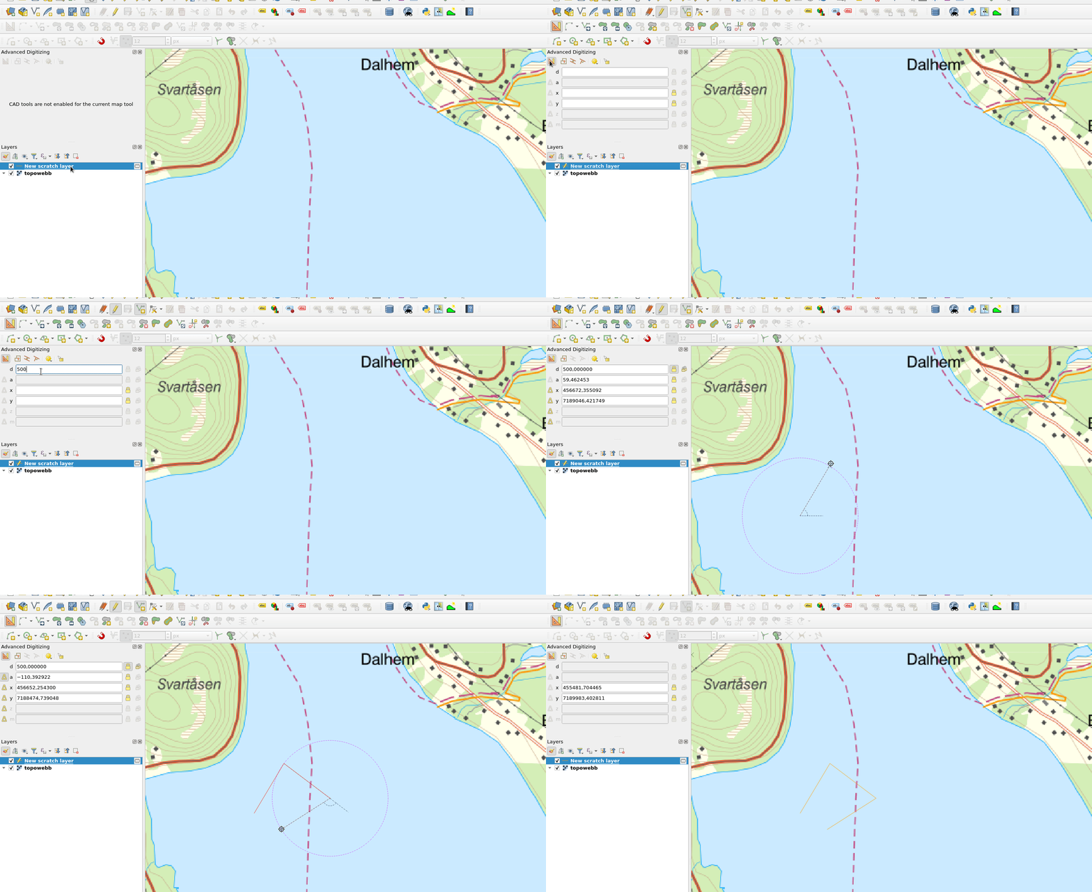
Use advanced digitizing panel:

enter image description here

3
  • Something weird is going on. Now that I've restarted QGIS, both Advanced Digitizing and marker line with "meters at scale" setting work as I've expected. But both of them were positively measuring distance wrong before. Will update if I figure what's happening. Thank you for your answer. Commented Mar 20, 2022 at 15:37
  • Upd: and no, it's just that the project somehow lost ellipsoid for measurements on reload. Using Advanced Digitizing near Uranium City with d=10000 while using EPSG:3857 results in a segment 5 km long (as measured in "Ellipsoidal" mode with ellipsoid WGS 84 (EPSG:7030)). I want a way to draw a line that, when measured, is 10 km long (corresponds to a 10 km long line on actual earth). Commented Mar 20, 2022 at 15:49
  • 1
    Yes- it seems like ellipsoidal is not supported in advanced digitizing github.com/qgis/QGIS/issues/30682
    – Baswein
    Commented Mar 20, 2022 at 23:30

Your Answer

By clicking “Post Your Answer”, you agree to our terms of service and acknowledge you have read our privacy policy.

Not the answer you're looking for? Browse other questions tagged or ask your own question.