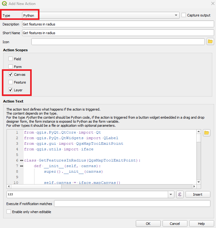
You can make use of an Action on the attribute form.

Once the Action is configured, you can drag it into your form as usual.

The code
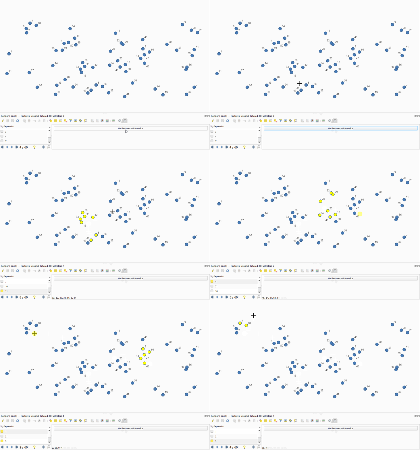
Here I subclass QgsMapToolEmitPoint and give it some custom functionality. Namely, leveraging QgsSpatialIndex to find the nearest features to the point clicked on the map canvas within a given distance. Conveniently, the list of feature IDs returned by the QgsSpatialIndex.nearestNeighbor() method are already sorted by distance.
I perform a selection of the found features to provide some visual feedback.
The tool can be unset by pressing the X key.
I am sure there is a more elegant way of displaying the returned feature IDs, this was a quick hack. Suggestions welcome.
from qgis.PyQt.QtCore import Qt
from qgis.PyQt.QtWidgets import QLabel
from qgis.gui import QgsMapToolEmitPoint
from qgis.utils import iface

class GetFeaturesInRadius(QgsMapToolEmitPoint):
    def __init__(self, canvas):
        super().__init__(canvas)

        self.canvas = iface.mapCanvas()
        self.lyr = iface.activeLayer()

        self.num_feats = self.lyr.featureCount()
        self.features = self.lyr.getFeatures()
        self.index = QgsSpatialIndex(
                         self.features,
                         # full feature geometry is stored,
                         # otherwise only the feature bounding box is used
                         flags=QgsSpatialIndex.FlagStoreFeatureGeometries
                         )

        # get the layour of the attribute form
        self.layout = form.children()[1]
        item_count = self.layout.count()

        # remove any QLabels already in the layout
        # (otherwise they stack up each time the action is triggered)
        for i in range(item_count):
            item = self.layout.itemAt(i)
            if isinstance(item, QLabel):
                self.layout.removeWidget(item)

        # add a label to the attribute form to display the found feature IDs
        self.label = QLabel()
        self.layout.addWidget(self.label)

        # fire the handle_click method when the canvas is clicked
        self.canvasClicked.connect(self.handle_click)

    def handle_click(self, evt):
        self.lyr.removeSelection()
        # evt is a QgsPointXY of the click location
        # num_feats is the maximum number of features for nearestNeighbor to find
        # 200 is the distance which you will need to adjust (perhaps dynamically somehow)
        fids = self.index.nearestNeighbor(evt, self.num_feats, 200)

        # select the features for visual feedback and write the IDs to the label
        self.lyr.selectByIds(fids)
        self.label.setText(', '.join([str(id) for id in fids]))

    # override the keyPressEvent of QgsMapToolEmitPoint
    # to deactivate the tool when X is pressed
    def keyPressEvent(self, event):
        if event.key() == Qt.Key_X:
            self.lyr.removeSelection()
            self.canvas.unsetMapTool(self)
            self.layout.removeWidget(self.label)

# instantiate the tool and set it on the map canvas
canvas = iface.mapCanvas()
tool = GetFeaturesInRadius(canvas)
canvas.setMapTool(tool)
Result


