0

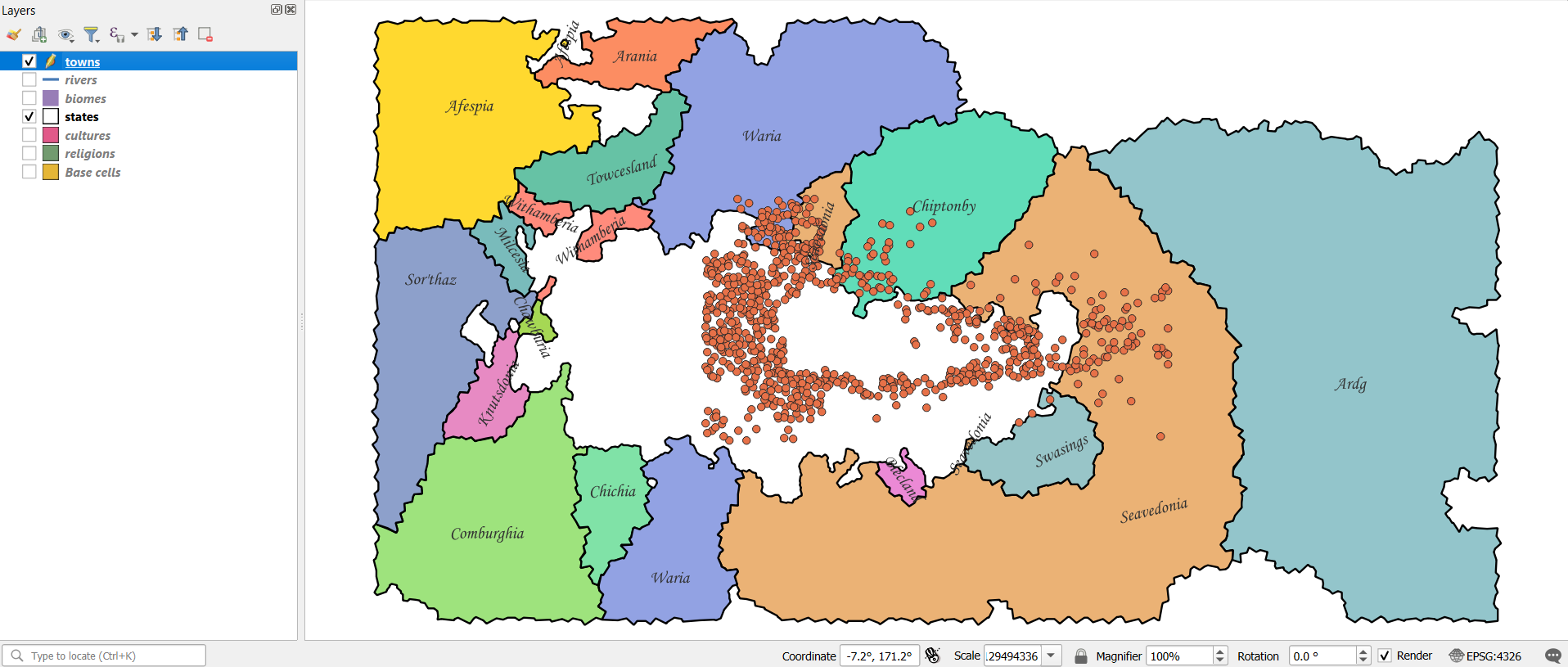
I'm new to QGIS, please bear with me. I've imported several layers from a fantasy map generator, all at the same scale / CRS. But the final one, appears to be smaller in extent - the proportions are correct, but it's somehow scaled down in the export/import process.

I've searched for and tried various resizing, scaling, vtransform processes, but nothing's quite getting the result I need. I want the extent of this layer to match that of the map canvas.

Any advice?

Screenshot

New contributor
brownbear29 is a new contributor to this site. Take care in asking for clarification, commenting, and answering. Check out our Code of Conduct.

1 Answer 1

0

You wan to georeference the points layer.

In QGIS this can be done for both vector and raster data using the georeferencer.

The tool is quite well documented in the official documentation: https://docs.qgis.org/3.34/en/docs/user_manual/working_with_raster/georeferencer.html

But you create control points between the layer you are trying to scale and the other layer and it does the scaling.

1
  • Thanks. I’ll give that a go. Commented 1 hour ago

Your Answer

By clicking “Post Your Answer”, you agree to our terms of service and acknowledge you have read our privacy policy.

Not the answer you're looking for? Browse other questions tagged or ask your own question.