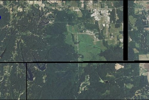
I am trying to create a raster base layer from NAIP ortho imagery. Unfortunately for me, the area of interest is very near the intersection of four image files. I have tried a few approaches to combining them into a single map layer:
- Naively grouping them together in a GeoServer Layer group
- Combining them with GeoServer's ImageMosaic plugin
- Merging them with gdal_merge.py
In all cases, the result has the same visual problem of ragged black lines where the images meet. See the example image, below. The black lines appear at the edges of each of the individual files, they are not merely an artifact of merging the images, so in a sense this isn't a surprising outcome -- just annoying.
What is the correct procedure to join these orthoimages into a reasonably seamless layer? Is this even a practical thing to do?

A few more details:
- The imagery came from the USDA Geospatial Data Gateway, National Ag. Imagery Program Mosaic listing
- The files were in MrSID format, but I've also created GeoTIFF copies for the gdal_merge.py approach
- In addition to the MrSID files, the data set included shape and prj files.
- The images use projection NAD83 / UTM 16N, so I've been using EPSG 26916
- I'm a programmer, not a GIS expert, so my knowledge of this area is pretty limited

-srcnodata 0 -dstnodata 0.