4

I am wanting to get a copy of the OS 1km Grid layer.

I have found these previous questions:

But neither provide the information I required.

The first question does provide some links to the OS web site but these now return the 404 error. A subsequent comment mentions its half way down this page:

But which specific item should I be downloading? It is not obvious!

2
  • What do you intend to do with the data you download? If you provide us with a bit of background on your project we can advise you on the best dataset to download.
    – Rob Lodge
    Commented Nov 26, 2013 at 11:59
  • Currently I'm wanting to use this layer to allow me to produce a list of the selected 1km grid squares. The list then used to select the corresponding tiles of LiDAR.
    – RobN
    Commented Nov 26, 2013 at 12:26

5 Answers 5

8

Many of these answers are now out of date with dead links.

There is useful github here with OS National Grid Shapefiles at various scales:

https://github.com/charlesroper/OSGB_Grids

2

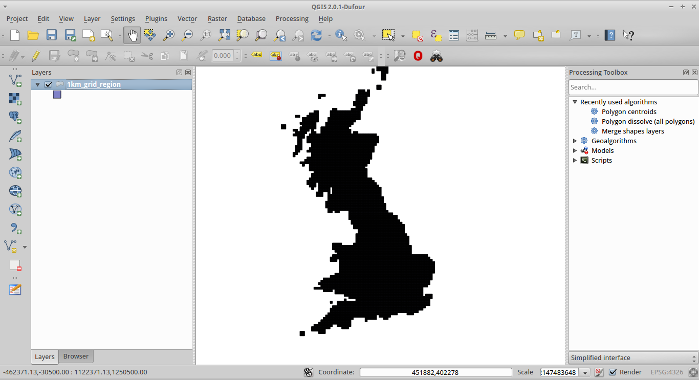
These can be found here. These were found via the wonderful ShareGeo website: http://edina.ac.uk/projects/sharegeo/content.html

Edit - they can be quite slow to load - but do cover the entirety of Great Britain. No coverage for Northern Ireland unfortunately:

1km grid

6
  • Unfortunately I dont have access to Edina, my student access ran out a few years ago!
    – RobN
    Commented Nov 26, 2013 at 12:28
  • I'm confident you can still apply for access, even if no longer registered at a formal academic establishment. My understanding was that ShareGeo is for the University of Life - will be disappointed if you can't gain access. Try here: sharegeo.ac.uk/password-login Commented Nov 26, 2013 at 12:33
  • OS doesn't map NI so that is why there is no coverage.
    – Ian Turton
    Commented Nov 26, 2013 at 13:00
  • I'm surprised the 1km grid is not downloadable directly from the OS website.
    – RobN
    Commented Nov 26, 2013 at 14:20
  • Me too. Any luck getting an Edina login? May take some time to process your request. Best of luck with it. Commented Nov 26, 2013 at 14:23
0

Here is a link where you can download the whole set in ESRI Shapefile format

Download Here

This will probably be up for a few days so can you please download ASAP

5
  • While the answer is correct, if the link is only up for a few days then this thread will suffer the same fate as the previous two.
    – HeikkiVesanto
    Commented Nov 26, 2013 at 16:14
  • 1
    @Vesanto totally understand but will need to check internally how Ordnance Survey can best do this for other users rather than keep it where it is.
    – tjmgis
    Commented Nov 26, 2013 at 16:47
  • Not sure if the license for this dataset would allow it, but I could upload this to GitHub which would be as stable a home as we can get right now. Commented Nov 29, 2013 at 10:16
  • With regard to the license, the best option would be to stick an Open Data license on it if we can. E.g., opendatacommons.org Commented Nov 29, 2013 at 10:19
  • 1
    I've added the files to Github and created GeoJSON versions so that can be previewed/used from there directly. Take a look: github.com/charlesroper/OSGB_Grids. Note, the 1km GeoJSON layer is too big to preview in GitHub. Commented Nov 29, 2013 at 14:21
0

About as accurate as I have seen:

http://www.ordnancesurvey.co.uk/docs/maps/national-grid-map.pdf (from the OpenData page)

The previous post is referencing PAI (OS Positional Accuracy Improvement), which was done about a decade ago now, so obsolete and hence the 404.

I don't think there is a 1km grid layer.

0

Ordnance Survey's GitHub organisation now has a repository containing a GeoPackage of these grids at various resolutions (including 1 km): https://github.com/OrdnanceSurvey/OS-British-National-Grids.

Your Answer

By clicking “Post Your Answer”, you agree to our terms of service and acknowledge you have read our privacy policy.

Not the answer you're looking for? Browse other questions tagged or ask your own question.