3

I have several points with the same coordinates in one layer and of course they are located on top of each other.

Is there a way to separate these points automatically (not manually)? I don't want to label them differently nor can I change the coordinates (although there's actually no other way...). But is there a trick or a tool I can use? I'm working with QGIS 2.0.1.

4
  • Sounds like you want to do some clustering. This previous question might help you: gis.stackexchange.com/questions/11342/…
    – Craig
    Commented Mar 7, 2014 at 13:37
  • 1
    What do you mean by 'separate'? You want to display them differently? Or analyse them differently somehow?
    – Simbamangu
    Commented Mar 7, 2014 at 13:48
  • Interesting problem. I second Simba's question, but am also curious what sort of data you're representing. I'm wondering what data model has a many features to one geometry relationship, but in which it doesn't make sense to classify/symbolize the features differently. Something seems broken.
    – elrobis
    Commented Mar 7, 2014 at 14:24
  • Simbamngu - actually both, but first of all, display them differently. elrobis - I'm representing measurements on different machines that are in the same place. The problem is that if I have 20 measurements for one coordinate, i can't symbolize them differently, that wouldn't create a clear representation.
    – qgs
    Commented Mar 7, 2014 at 15:25

3 Answers 3

1

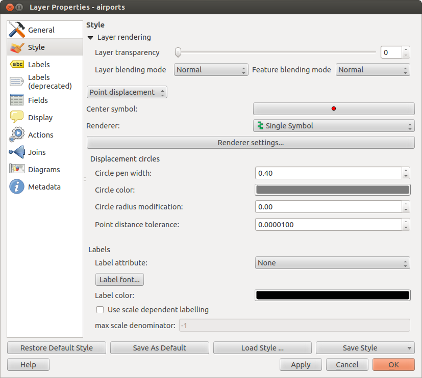
In the Vector Layer Properties -> Style dialog, try setting the renderer to Point displacement.

enter image description here

3
  • Thank you for your answer. I tried this but there's another problem: if I do it with the point displacement style, i have a problem if i want to display for example all the values above 1000: if I have two measurements in one place and one is below 1000 and the other one is above, it isn't displayed if i mark all the attributes above 1000 in the attribute table.
    – qgs
    Commented Mar 10, 2014 at 7:47
  • Sorry, I do not understand your description of the secondary problem. Please clarify.
    – dakcarto
    Commented Mar 10, 2014 at 16:41
  • i have a point with coordinates displayed in the map window. The point a description for machine A, machine B and machine C. Each machine has an own entry in the attribute table, but they are displayed in one point because they have the same coordinate. But i want to separate them without changing the coordinate.
    – qgs
    Commented Mar 11, 2014 at 10:38
1

enter image description here

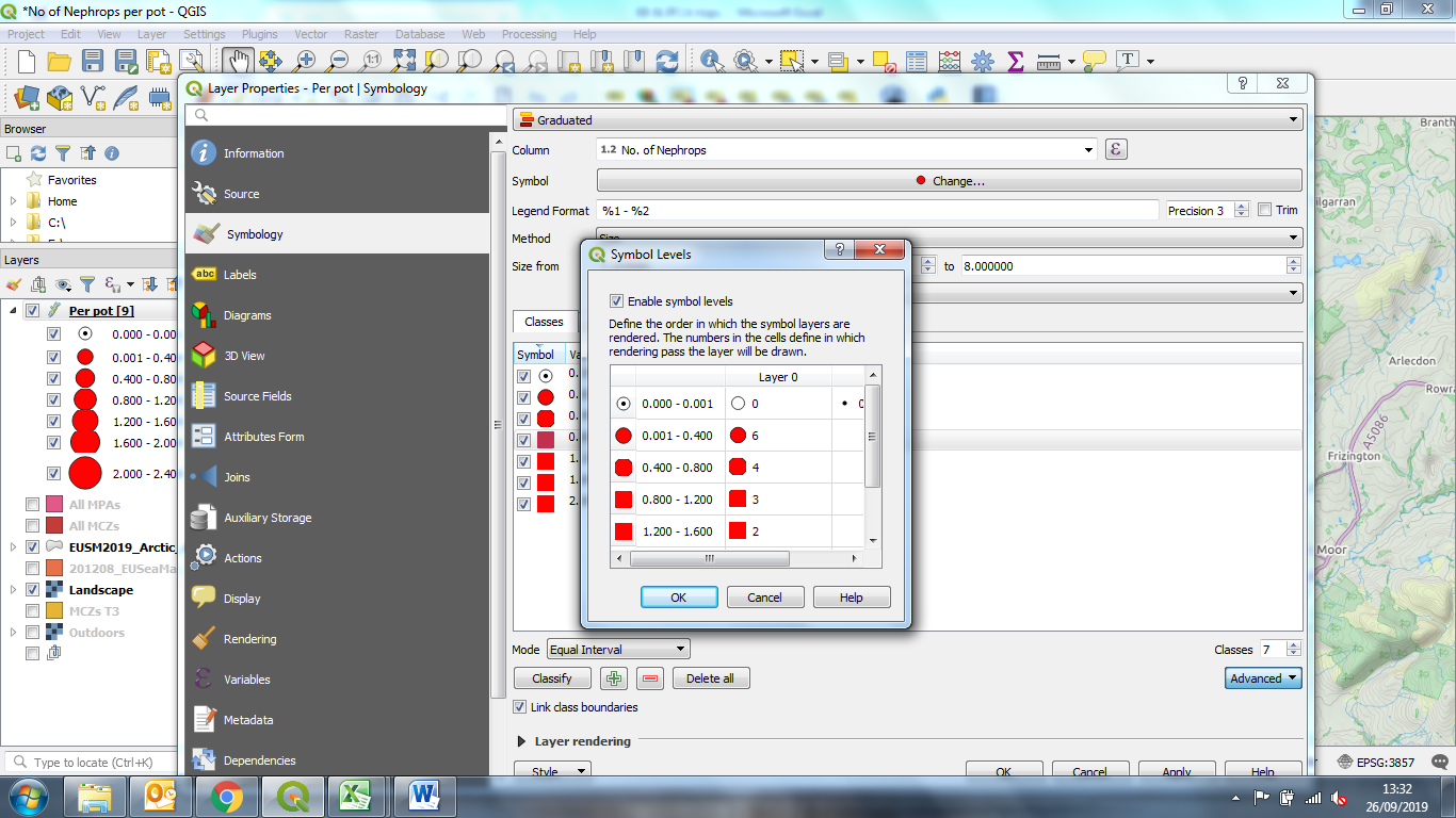
Click on advanced then symbol levels then number the symbols by choosing which symbols you want at the front

0

Concerning your comment on @dakcarto 's answer your problem seems slightly different.

The use case with the machnines (A,B,C,...) located at similar points sounds like a one-to-many relation to me, wich is a matter of data modelling.

You need two tables, one with your points and one for your machines (table without geometry). The latter needs an attribute that refers e.g. to the points ids.

Then under Project>Properties>Relations you need to define a relation by selecting both layers as well the referenced (points ids) and referring (machines attribute containing point id) attributes.

This will generate an embedded form in the points form listing all the machines related to that point.

(Applies for QGIS 3.x as well of course)

Your Answer

By clicking “Post Your Answer”, you agree to our terms of service and acknowledge you have read our privacy policy.

Not the answer you're looking for? Browse other questions tagged or ask your own question.