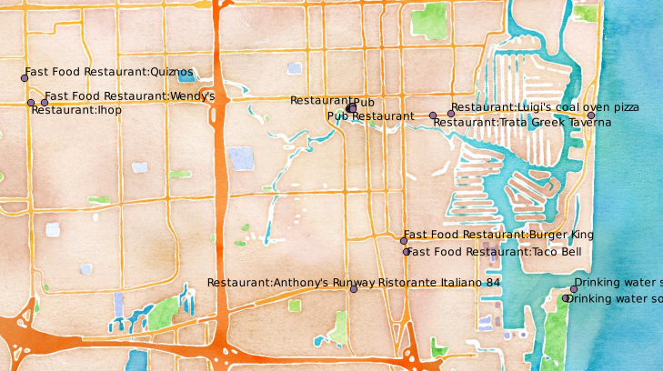
I am doing a project on food trucks for my Intro to GIS class and am looking for locations of places to eat here in South Florida to overlay with places of business. I would like to make a map of which employees have no place to eat for lunch to provide to a non-profit organization that has a job-training program on a food truck.
-
Possible duplicates: GIS data for fast food industry and Available US State or National business (or employer) database lists?– RyanKDaltonCommented Apr 16, 2014 at 14:14
-
I don't feel this is a duplicate of those questions. The question is specifically asking about Florida. Unlike those other questions, the asker has a clear research goal in mind thus making it easy for the responses to be tailored towards their purpose. This question itself could definitely be used as a reference for other researchers in Florida, or others hoping to approach the same type of problem.– KotebiyaCommented Apr 16, 2014 at 14:29
3 Answers
Cloudmade do extracts from OpenStreetMap data suitable for loading into Satnavs or GIS packages. For example, the Florida data is here:
http://download.cloudmade.com/americas/northern_america/united_states/florida#downloads_breadcrumbs
if you download and unzip florida.poi.gpx.zip you'll see a florida_Eating_Drinking.gpx file which has coords and names of restaurants. These files can be read into QGIS or any mainstream GIS package.
The Cloudmade files seem to be a couple of years old, if you want more up-to-date locations you can probably get that from OpenStreetMap itself, but there's a bit more data-wrangling to do.

OpenStreetMap is your best bet. You can download the data using built-in tools in QGIS. See the step-by-step instructions at http://www.qgistutorials.com/en/docs/downloading_osm_data.html
It seems like you are looking for a couple of different resources. Now, I actually found an interesting administrative resource you may want to look into here. From what I can tell, it is tax roll data that lists information on businesses that include address, and census block group id, thus allowing it to fit into GIS models. Not only that, according to the codebook, this data seems to identify businesses that are restaurants in the field "DOR_UC". So, you have data for locations of restaurants, but that seems to be only a part of what will help with your problem.
The next part is comparing this with areas high clustering of workers who are not near places to eat.
Your next resource, the LEHD Workforce Area Characteristics (WAC) will tell you the demographic characteristics of businesses, and thus can give you an approximation of where the densest areas of workers are. If you want to know more about how to use this dataset, consult the technical document. And for reference, you'll be using this shapefile for the LEHD data.
