2

What I have is a route layer of a river and points layer with associated temperature data (temperature of the river) that were collected using an airplane. The path of the points does not match the path of the river, but the points are in the vicinity of the river. My goal is to calculate river km locations of those points along that river layer. I could do this manually, but there are over 600 points. Is there a way to find locations for all of those points on the route layer that is river?
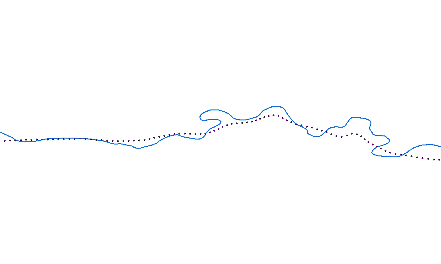
This is how my data looks like

2 Answers 2

3

When it comes to the distance along a linear feature, linear referencing is the way to go.

The first step is to create routes if your feature class is not M-aware. Maybe this is already the case for you as you mentioned "route" in your question.

When you have routes, you just need to use "Locate feature along route" and you have the distance to the line as well as the position on the river for each point.

4
  • Thank you. Yes, I had previously created a route layer of the river with the M value. Using the tools above I was able achieve what I was looking for.
    – Alex
    Commented Apr 15, 2014 at 22:02
  • @PolyGeo indeed, I was still with the older version in mind. I've edited the answer.
    – radouxju
    Commented Apr 15, 2014 at 22:45
  • I would be surprised if Create Routes has not been in ArcGIS for Desktop as long as Linear Referencing because its ArcInfo Workstation equivalent of ARCROUTE was usually first step of any Dynamic Segmentation work.
    – PolyGeo
    Commented Apr 15, 2014 at 22:51
  • you are right, "create routes" was already available in argis 9.3 (and probably older). I had not noticed, could have saved me a lot of time. Thanks for pointing.
    – radouxju
    Commented Apr 15, 2014 at 23:16
0

Depending on the algorithm you want to use for assigning the values to your stream stations there may be several ways to do this. However, I suggest you use Feature Vertices To Points (Data Management) to convert all the vertices of your stream to point. Then, using the Near (Analysis) find the closest point (vertices on the stream) to the temperature points. Finally you need to join the tables to add the desired values to stations on your stream. If you want the values on specific stations (such as 1km , 2km , 3km ...) first you have to create the points on these station (see this:Methods for splitting line features) and then using Feature Vertices To Points get the points and do the near analysis.

Your Answer

By clicking “Post Your Answer”, you agree to our terms of service and acknowledge you have read our privacy policy.

Not the answer you're looking for? Browse other questions tagged or ask your own question.