41

Besides being a GIS user I'm a big computer game fan.

Games like Civilization, Minecraft, World at War and many others have a very powerful engine to display huge maps in a beautiful way.

Is it possible to use a game engine to display GIS data for a better comprehension or visualization of the environment?

0

15 Answers 15

20

SimCity actually has the inbuilt ability to import USGS DEM data into it to use as a real-life terrain.

Of course if you use FME then you can create a USGS DEM out of almost anything, so you could get a custom SimCity landscape using any terrain data you have lying around.

3
  • 1
    nice plug - working with FME Server currently - a great tool but needs an 'easter egg game' built in when a job fails... (ask Dale to add one in)
    – Mapperz
    Commented May 19, 2011 at 21:28
  • I know... I try not to, but in this case I couldn't resist! I'll chat with Dale. But I do put easter eggs in the training materials - for example if you have the FME Server 2011 training manual you can play 'spot the lizard', and the last page of the 2010 Desktop manual has instructions on how to turn it into a paper plane! Commented May 20, 2011 at 16:03
  • Nice - I have a nice aerodynamic paper plane now. :)
    – Mapperz
    Commented May 20, 2011 at 16:10
15

When I worked at Microsoft Aces Studios (the makers of MS Flight Simulator and Train Simulator) we had a huge GIS pipeline that drove all of the content. You would be surprised how good some content looked after you dropped decent elevation data. I was personally surprised to find out how many people sold GIS data as Flightsim extensions.

Polylines classified as roads rendered as actual traffic with a real road, urban area polygons would render as autogen-buildings, railroad polylines would be drivable railroads, lake polygons would render as water bodies, traffic signs would be points features... it was all pretty crazy cool IMHO. If you look at the Trainsim 2 video demos on youtube (a project that got canned), it is amazing to think that all the items in this scenery are driven by real-world gis data, down to the traffic signs.

And yes, editing content sometimes involved some sprinkles of ArcMap :)

If you feel like trying some of this stuff out, but you don't want to use MS Flight Sim, there is an open source project that aims to do the same thing: FlightGear. You can download Openstreetmap data and load it! Heck, even GDAL, the famous GIS data swiss army knife supports flightgear as a readonly datasource, so you can grab the scenary and export it to your PostGIS, FileGDB or whatever other vector geospatial format it supports.

13

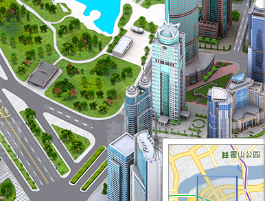
I love the Chinese equivalnt of Google Maps - http://map.baidu.com/

It certainly looks like Sim City.. Have a look at some Shanghai skyscrapers

Also path finding algorithms for games and GIS work in the same way.

skyscrapers

10

I saw a demonstration of the TopoMC program for MineCraft at the OSGEO-PDX conference back in April. It is a loose collection of Python programs that will import USGS data into Minecraft.

Here is a thread describing the project:

http://www.minecraftforum.net/topic/143187-topomc-generating-minecraft-worlds-from-topographic-data/

And here is the Git-Hub page where you can download the code: https://github.com/mathuin/TopoMC

Further thought: I think that this project shows that it can be a challenge to bring GIS data into a game. You often need to bring the data into whatever terrain system the game uses. Games which just act as viewers of data are rather rare, and tend to be boring to boot.

2
  • With dmsnell's exception for flight simulators.
    – jvangeld
    Commented May 20, 2011 at 16:34
  • That's such a cool MineCraft tool! Thanks for the link. Commented Aug 26, 2011 at 20:41
8

Historical 'TOCA Touring Car Championship' (Playstation 1) was the first game to use real 3D (and geo-related) GIS data (Landline dataset back then) for landscaping the tracks from GB Ordnance Survey. So every bump and turn was more real than fictional based tracks.

http://en.wikipedia.org/wiki/TOCA_Touring_Car_Championship [but NOT Lavaland (bonus track)]

Recently Google Maps API is becoming more useful for game developers....

Travel Game using Google Maps API http://googlegeodevelopers.blogspot.com/2011/05/travel-game-google-earth-is-your.html

1
  • 2
    Actually, Jet Fighter III came out in 1996 and displayed satellite imagery draped over terrain data. The game came with several CDs full of data and the experience was a magnitude more realistic than the previous generation of flight games.
    – dmsnell
    Commented May 20, 2011 at 12:27
6

The digitalurban blog written by the guys at University College London regularly mentions visualisation of geo data with game engines e.g. CryEngine used in Crysis.

5

Gaming engines are a very popular platform to obtain appealing visuals for military simulation. For example:

3

There is a (totally unofficial for obvious reasons) plugin for Microsoft Flight Simulator using Google Maps data for terrain rendering.

3

There also is Ovi Racer for Nokia handsets. It uses ovi maps data to "race" through "real" streets. You can create tracks anywhere ovi has data about.

3

Linked to the subject:

  • http://osm2xp.com/ - Import Open street maps data into Xplane, for a true photoreal experience.
  • http://wiki.openwebglobe.org/doku.php?id=webgl - With the OpenWebGlobe SDK you can create your own virtual globe applications. You can develop your new application in your favorite language like C++, C#, Visual Basic, Python, JavaScript.
2

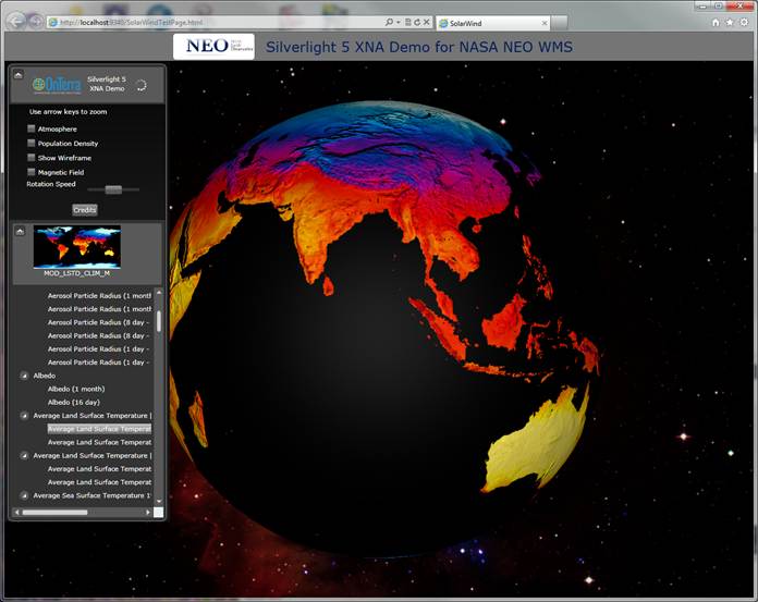
With XNA support, it Looks like Silverlight 5 will be more like a game platform.

The GIS in XML blog has a good writeup on this.

enter image description here

2

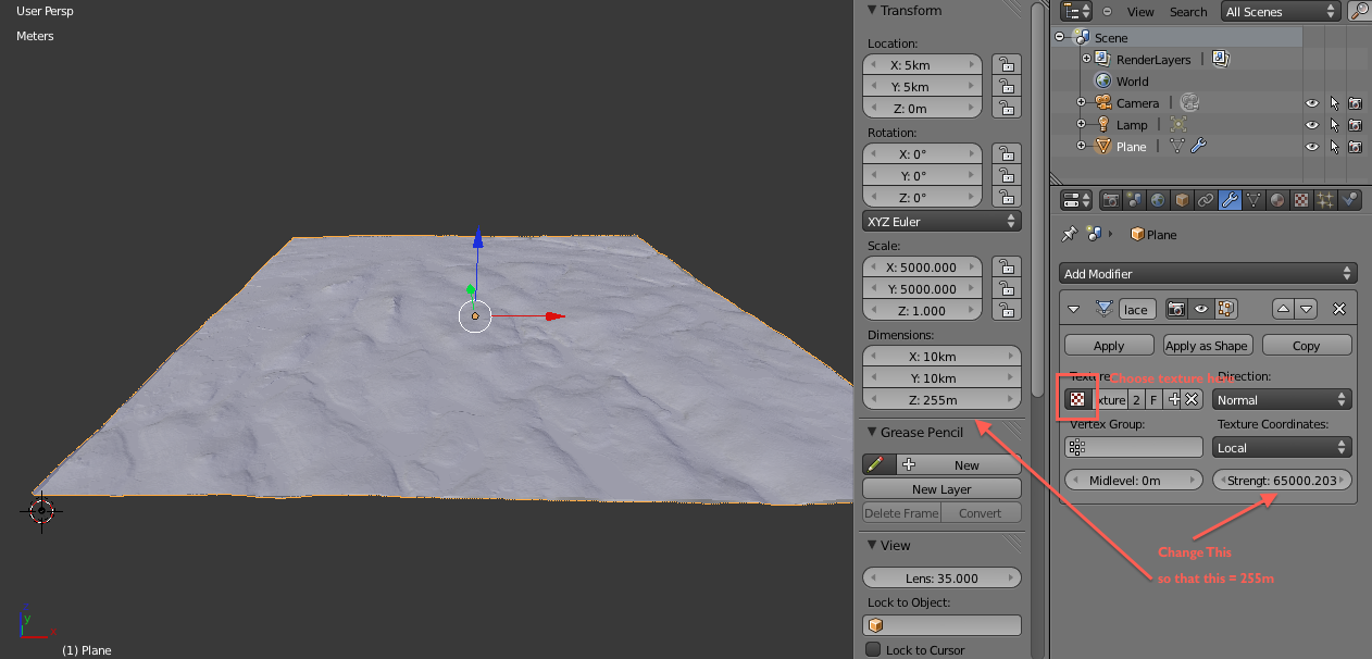
Stuart Eve is experimenting with using game engines to display archaeological GIS data. He coined the term of embodied GIS (see this paper for more details) and has an upcoming (hopefully) series of blog posts on:

using combination of 3D modeling software (blender), gaming-engine software (Unity3D) and conventional GIS software (QGIS)

to explore archaeological landscapes. Part I is here:

Embodied GIS HowTo: Part 1 – Loading Archaeological Landscapes into Unity3D (via Blender)

enter image description here

1

UK's Ordnance Survey has:

created a Minecraft® world made with digital map products - freely available as OS OpenData™. The world consists of more than 22 billion blocks representing over 220,000 square kilometres of mainland Great Britain and surrounding islands.

enter image description here

More information at http://www.ordnancesurvey.co.uk/innovate/developers/minecraft-map-britain.html

0

The transport/urban planning simulator OpenTTD uses heightmaps (DEMs) to generate its game levels/maps. There is a substantial library of premade heightmaps for many parts of the world here.

Image

Your Answer

By clicking “Post Your Answer”, you agree to our terms of service and acknowledge you have read our privacy policy.

Not the answer you're looking for? Browse other questions tagged or ask your own question.