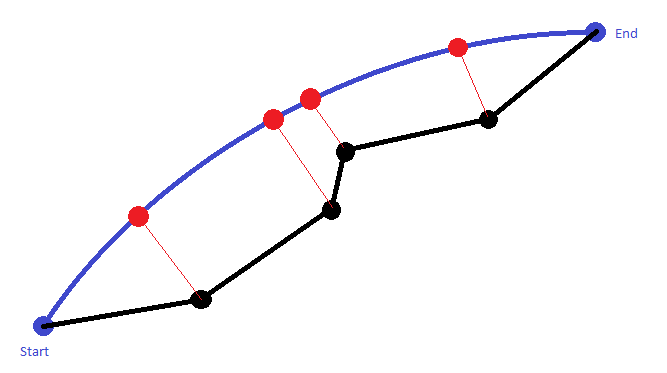
I have a route formed by some waypoints (black path) and I would like to project it over the great circle (blue path) connecting the starting and ending waypoint. With the work "project" I mean to find the Latitude and Longitude of the red points.
The red lines are the shortest distances between the black points and the great circle and I am able to calculate it as suggested by this website (section cross-track distance).
Can you tell me how I can calculate the geographical coordinates of the red points, if the only information provided is about the black route and the great circle?

