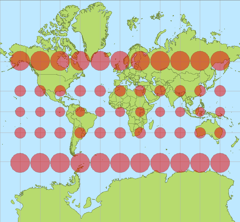
gdalwarp is doing the right thing: preserving total resolution of your image by changing the pixel-size.
WGS 84 / Pseudo-Mercator projection is heavily distorted when moving away from the equator. Thus, it could be discussed if the units should be called "Pseudo-meters". One meter in reality is approximately 1/cos(lat) pseudo-meters.
You can calculate the approximate pixel size for your raster image:
30m / cos(69.53°) = 85.78 pseudo-meters
Compare this with your gdalinfo output.

