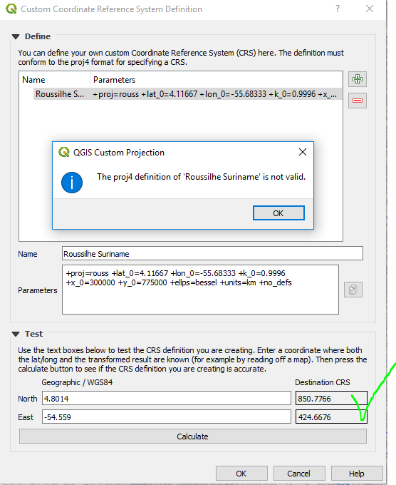
In QGIS 3.4 I'm trying to add a custom projection that was used for topographic maps of Suriname in the 1950s. I have the parameters from an article about historical CRS used in the country. Using the proj documentation I defined the custom CRS. I even tested it and the returned coordinates confirm that the projection does what I want. However, when I click OK to add the custom CRS, I get the popup: "The proj4 definition of 'Roussilhe Suriname' is not valid."

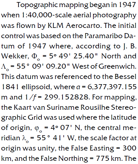
How can I test it, but then get the message that the definition is invalid? In any case, I now very little about proj4 and can't find the error. Below is a snip of the article containing the parameters.

