I have a 6 band Landsat image, RGB and 3 NIF bands. As far as the Band Interleaved by Line (BIL) method goes, the resulting image should have, and I quote ENVI manual:
the first line of the first band followed by the first line of the second band, followed by the first line of the third band, interleaved up to the number of bands. Subsequent lines for each band are interleaved in similar fashion. This format provides a compromise in performance between spatial and spectral processing and is the recommended file format for most ENVI processing tasks.
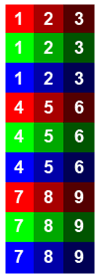
So with 6 bands, I should get something like this:

with the resulting image "streched" with the same row number from each of the band in sequential order, or 6 rowed blocks per the whole image.
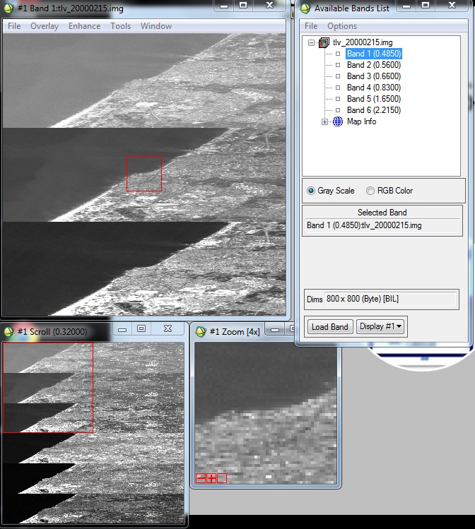
However, the result ended up like this:
 and with 800*800 pixels, each segment is clearly more than just 6 rows.
I am at lost as to why it's displayed this way.
Appreciate any help in regards to the matter.
