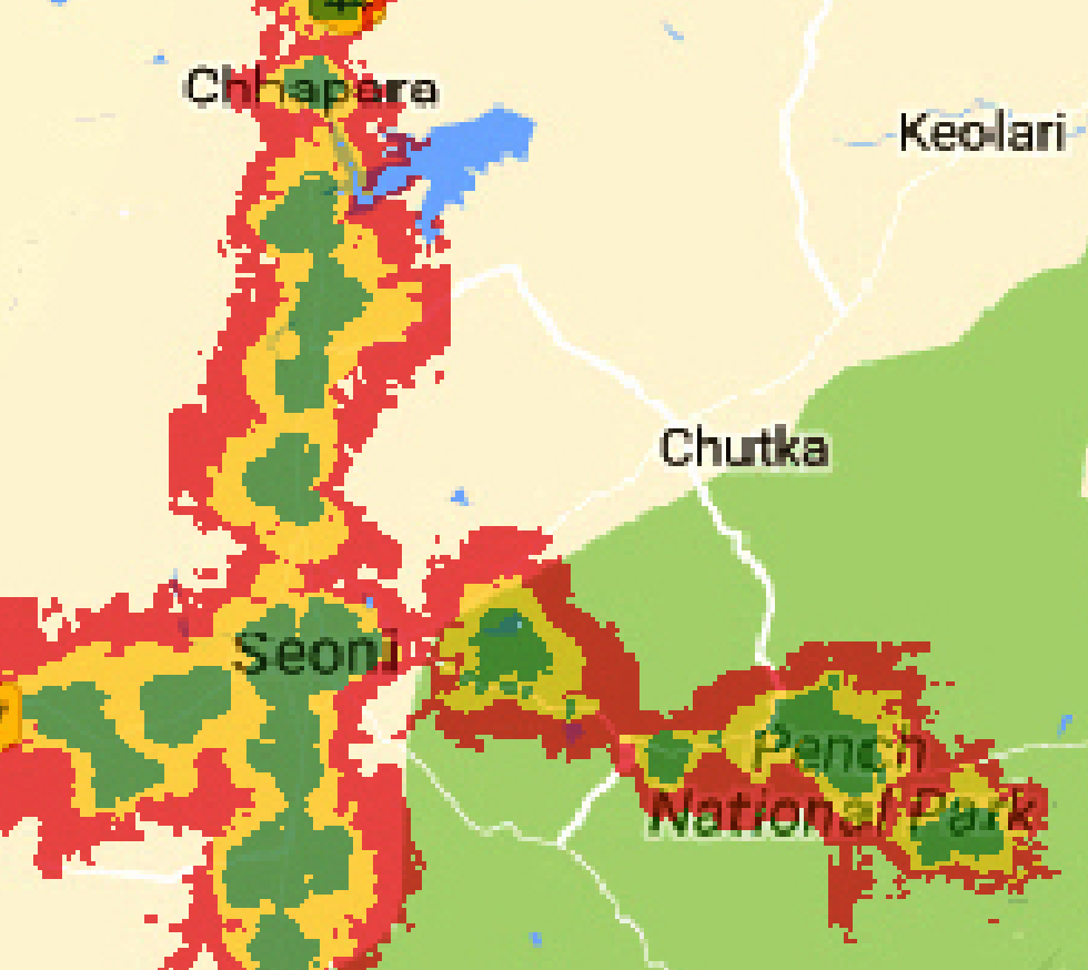
I digitized a map using QGIS. What I have right now is simply the geolocated version of the picture below (including labels, streets, lakes etc.), i.e. the file does not have any layers or attributes. What I aim to do is to create separate shapefiles/polygons for the green, yellow and red areas displayed in the image below. Thus these should be created based on the respective area's color in the picture.
I'm a total beginner with QGIS and did not find anything on how to do this online.

