4

I am currently trying to calculate fish stock density for various stocks in the NE Atlantic. My habitat areas are too large to use UTM and I was wondering how I would find the best geo-coordinate system to use? My area covers the entire FAO fishing area 27. Any suggestions would be really helpful.

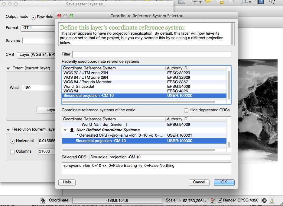
I have changed the meridian as suggested see screenshot. Does this mean that I simply need to change the '10' figure in order to define any new longitude as the central meridian? In other words, currently the central meridian is '10' but if i wanted it to be 15, I simply have to edit this in?

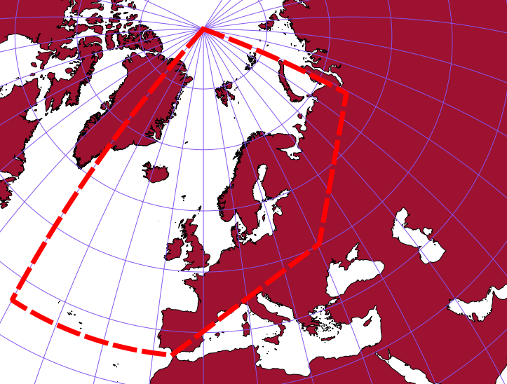
Lambert equal area projection enter image description here
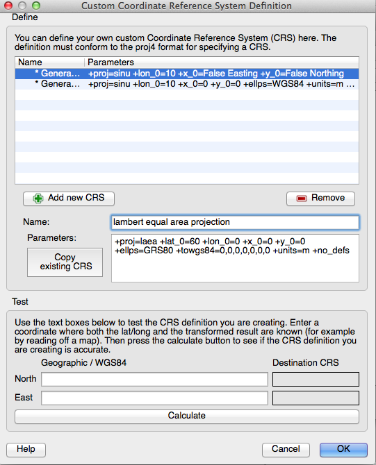
Saving new CRS projection

enter image description here

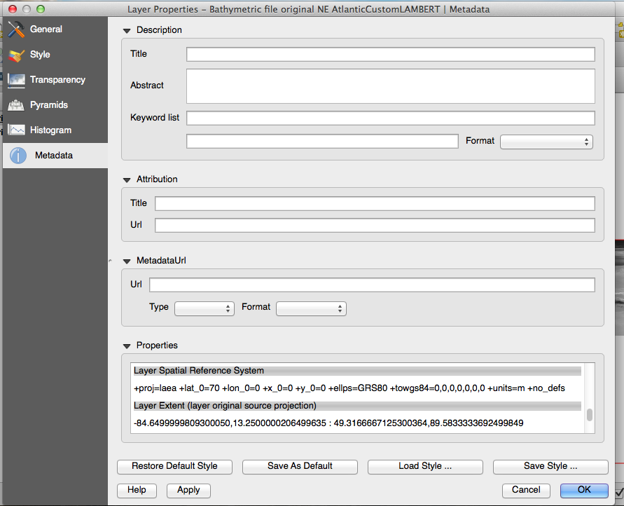
Meta Data tab of warped tiff:

enter image description here

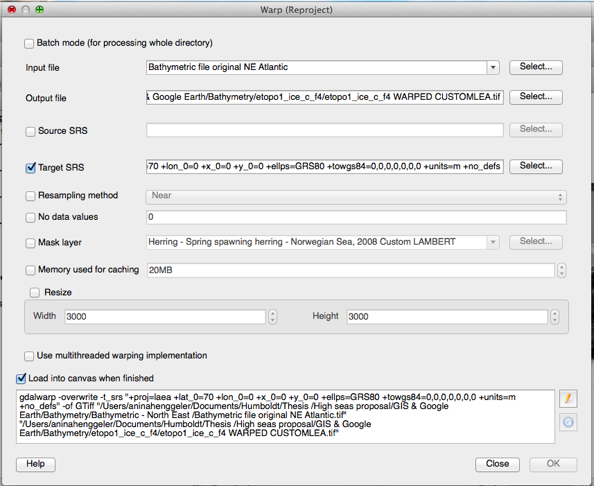
Raster --> Projections --> Warp

enter image description here

7
  • If you want to work with both meridians, you should create two custom CRS. Just exchanging the value does not automatically reproject all coordinate values.
    – AndreJ
    Commented Sep 18, 2014 at 12:25
  • Ok, how do i get the system to re-project all the coordinates? Currently, it appears to me to be registering the new prime meridian of 10 (see the test section in the new screen shot above), is this correct? Also fyi I would be using separate Qgis projects for every new custom CRS.
    – anina
    Commented Sep 19, 2014 at 6:10
  • Supposed your original coordinates are in WGS84 lat/lon: Load the data with EPSG:4326, then rightclick -> Save As ... to a new name and the custom CRS. Do not use Set CRS for layer, it will not reproject the coordinates.
    – AndreJ
    Commented Sep 19, 2014 at 6:32
  • Do you mean 'save as' for the entire project or each individual layer once they are all loaded? This is the process I have followed: 1. loaded the raster which is in EPSG:4326. 2. Selected 'settings' --> 'Custom CRS' --> entered the following into the 'parameters' field "+proj=sinu +lon_0=10 +x_0=False Easting +y_0=False Northing" and clicked ok --> Then right clicked the layer in question and next to the 'CRS' field clicked 'change' and selected the Custom CRS and clicked 'ok'.
    – anina
    Commented Sep 19, 2014 at 8:46
  • That's the wrong one. You have to save the layer to another file and CRS, add that to the canvas, and remove the old one. The Custom CRS also goes to Project -> Project Properties, CRS tab; with On-the-fly-reprojection enabled.
    – AndreJ
    Commented Sep 19, 2014 at 9:08

2 Answers 2

3

You are interested in density, so equal-area projection would be the most appropriate. However, your area is tricky because you have the pole + some low latitude (<40). (My first impression was to use a Lambert Azimuthal Equal area projection for North Atlantic but you are out of range). Therefore,a global projection is probably what you need.

I suggest the sinusoidal projection. You could customize it a bit by setting its central meridian in the middle of your area (around 10°). You can edit the proj 4 description file of your custom sinusoidal.

+proj=sinu +lon_0=10 +x_0=False Easting +y_0=False Northing

3
  • I have set the layer projection to EPSG 54008 world_sinusoidal. Can you please advise how to set the primary meridian? Additionally, is it reasonable to change the position of the primary meridian for each stock habitat area I am calculating (i.e. move the meridian in the middle of each new habitat area i am looking at)?
    – anina
    Commented Sep 18, 2014 at 9:39
  • It depends if you want to make a global map at the end (keep central meridian to 0), or not (you will have less shape distortions if you change the position of your central meridian)
    – radouxju
    Commented Sep 18, 2014 at 9:45
  • I just want to calculate individual habitat areas so no I do not want a global map at the end. So in other words I should change the position of my central meridian for each new area I calculate?
    – anina
    Commented Sep 18, 2014 at 12:14
2

I would suggest choosing a lambert equal area projection, centered roughly in the middle of your fishing zone:

+proj=laea +lat_0=60 +lon_0=0 +x_0=0 +y_0=0 +ellps=GRS80 +towgs84=0,0,0,0,0,0,0 +units=m +no_defs

which looks like this: enter image description here

12
  • This would include the entire area so it looks great. Is your suggested path '+proj=laea +lat_0=60 +lon_0=0 +x_0=0 +y_0=0 +ellps=GRS80 +towgs84=0,0,0,0,0,0,0 +units=m +no_defs' already centered to the middle of my zone? Do i enter this path into the parameters field found at: 'settings' --> 'custom CRS'? Please see new screen shot added above titled ' lambert equual area projection'
    – anina
    Commented Sep 19, 2014 at 9:12
  • The layer you show covers the whole world. Unfortunately, laea is not valid for the antipodal point, giving you error messages. So you better clip your data roughly to the hemisphere you are interested using degree borders before reprojecting to laea. My projection is centered on 0°E 60°N. You can change that with different lon_0 and lat_0 values.
    – AndreJ
    Commented Sep 19, 2014 at 11:05
  • OK I clipped the region to basically represent what you showed in the map but I am still receiving error message. Is my map not allowed to cross the 0 degree longitude boundary?
    – anina
    Commented Sep 19, 2014 at 12:43
  • I am not sure about restrictions for raster files using Save as.... Can you try Raster -> Projections -> Warp?
    – AndreJ
    Commented Sep 19, 2014 at 12:52
  • Ok i did that. How do I know if the file has actually been converted, seeing as that every time I import a file to Qgis it it asks for the CRS which i obviously set to the my target CRS. How do I know the coordinates have actually been changed?
    – anina
    Commented Sep 22, 2014 at 13:45

Your Answer

By clicking “Post Your Answer”, you agree to our terms of service and acknowledge you have read our privacy policy.

Not the answer you're looking for? Browse other questions tagged or ask your own question.