I'm looking to use a slope raster in a MCE however i am struggling to ensure it has the correct polarity. The polarity of my other two layers is high values = good and low values = bad. The slope ranges from 0 (good) - 36 degrees (bad) and therefore currently the polarity is the opposite of what i require. Ive tried to multiply the grid by - 1 in raster calculator which gives me this.
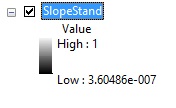
When i attempt to standardise the grid so the values range from 1 (good) to 0 (bad) i get this. 
Obviously i require all my layers to range from 0 - 1, and would like the areas of least slope to have high values once ive standardised them, does anyone know where i've gone wrong?

