3

I'm trying to find Open Data DEMs for a couple of personal mapping projects, for the following areas:-

  • Faroe Islands
  • Svalbard (Longyearbyen)

Ideally, with 100m resolution or better.

I normally use SRTM (using the Python elevation library), but the SRTM data only covers the southern half of the Faroe Islands. (SRTM only covers 60S to 60N).

For Svalbard, I had a look at Norway's Kartverket map portal, but even at the lowest resolution, the coverage seems to be restricted to the Norwegian mainland

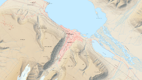
I've found a nice relief map of Longyearbyen here in JPEG2000 format, but it's not a DEM.

enter image description here

Is there an open data DEM for these areas? I've had a look on OpenData but not seen anything there..

2
  • I think that you should ask this question on Open Data Stack Exchange. Even though that may not have an existing Q&A, it would seem to be an on-topic question that could be asked of a community with expert knowledge of open data. For here it is a question that is too localized because it applies to two small areas. It sets a precedent for thousands of questions saying "Where can I find an open data DEM for tiny area X?
    – PolyGeo
    Commented Aug 6, 2017 at 0:13
  • 1
    The website with the relief map you linked to also has DTM's of Svalbard which may be of interest: Terrengmodell Svalbard (S0 Terrengmodell)
    – Joseph
    Commented Aug 7, 2017 at 9:37

4 Answers 4

4

The amazing ArcticDEM project has 2m and 5m coverage for much of the arctic, some of it available as time series. Not all of the data has been processed yet, but it looks like they have coverage of Svalbard and the Faroe Islands.

1
  • Nice find - hadn't seen that before.
    – BradHards
    Commented Aug 22, 2017 at 2:28
3

There is a DEM that covers 83N to 83S at 1 arc-second (~30m) resolution called ASTER Global DEM. A good description is available at https://lpdaac.usgs.gov/dataset_discovery/aster/aster_products_table/astgtm and you can download it from the usual USGS services (e.g. EarthExplorer). There are definitely tiles available (2 x 2 pattern) for the Faroe Islands.

Whether or not you consider it to be Open Data depends on your intepretation of the policies that apply. I'd suggest reading https://lpdaac.usgs.gov/dataset_discovery/aster/aster_policies and interpreting it for your specific circumstances. Of course you also need to consider the technical suitability for your mapping too.

1
  • Meta: While considering PolyGeo's consideration about whether it is on-topic for here, I wanted to point out that while SRTM does have some advantages, there is a wider ranging and equally high resolution data set with wider latitude limits.
    – BradHards
    Commented Aug 6, 2017 at 0:38
2

There is also another source of DEM which is ALOS AW3D30 Ver1.1, a 30 m resolution data, released by Japan Aerospace Exploration Agency (JAXA).

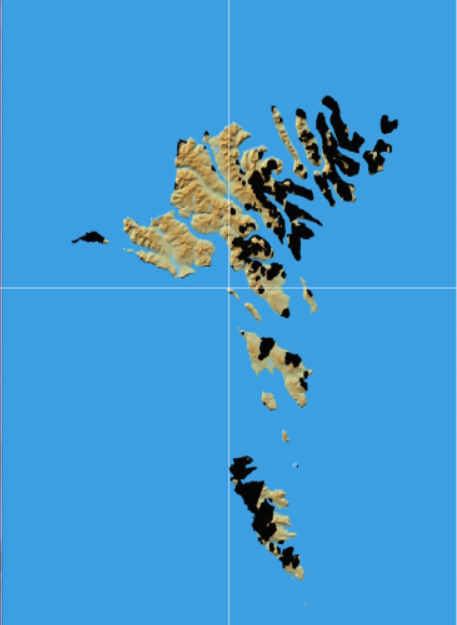
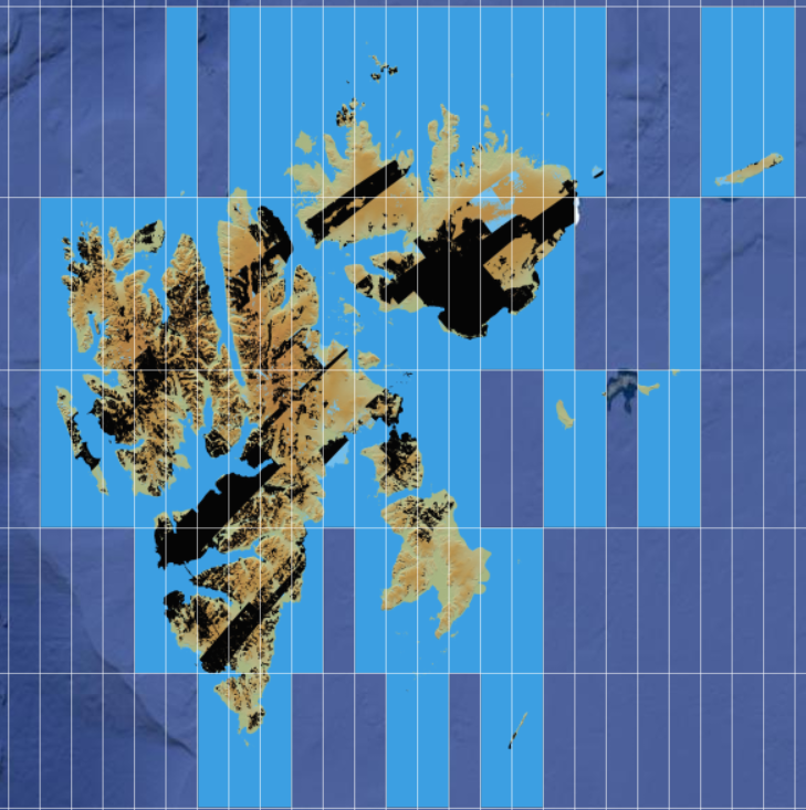
Unfortunately There are some black areas masked out due to cloud cover for both Faroe Islands and Svalbard (Longyearbyen), and I am not sure if the black areas will be updated in the future or not with the correct or processed DEM data .

enter image description here

enter image description here

But it looks like that the website is updated with new information from time to time so you can check the website later. But at least you can test the resolution of whether it is suitable or clear to your work.

1

Late to the party, but Norwegian Polar Institute also has a nice DEM with resolution varying from 2 to 50 m depending on area and progress in aerial scanning. According to the description, the data is updates several times a year. Check it here.

Your Answer

By clicking “Post Your Answer”, you agree to our terms of service and acknowledge you have read our privacy policy.

Not the answer you're looking for? Browse other questions tagged or ask your own question.