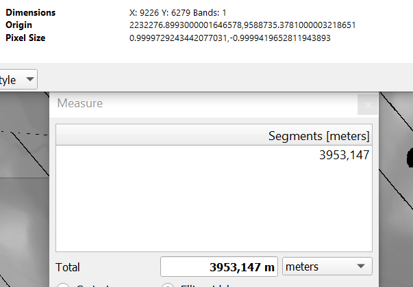
I'm currently sitting on a project where I have a DEM of an area that has been scanned. it currently has around 3-ish pixel per meter on export but I need to export it as 1 pixel per meter and also retain the coordinates of it. How would I go about doing this? As I understand I need to use the Warp tool maybe? But I've had no luck.
I've found a few tutorials but haven't been successful with them either. I'm a creative that's not usually working with GIS so I don't understand most of the terms so it's a bit hard to follow along to tutorials.
Here's an image of the problem, the x pixel count on the DEM is 9926 when its 3953m across, I need it to be 3953 pixels across in X

How can I do this?
