0

I am overwhelmingly failing at finding data about global poverty that is any more specific than at the country level.

Because poverty has such a wide definition I am open to really anything that is an indicator, like high infant mortality or others.

Any suggestions to point me in the right direction for data more specific than the country level would be great?

Preferably it is not raster data but data I can manipulate on Arc 10.1.

2
  • 1
    What level of administrative boundary would you seek for looking at something on a global scale? 1st order? 2nd? Would you be factoring in to equate terms to orders? And raster data can be manipulated in ArcGIS, so by that statement should we assume you don't have access to Spatial Analyst?
    – Chris W
    Commented Jun 8, 2014 at 21:55
  • Welcome to GIS SE! Would you be able to edit your Question to revise in response to the questions @ChrisW has raised in his comment, but also to explain whether/why this data needs to be in Mollweide projection which appears in the title but not body of your Question. AS a tip the title is usually best written last to summarise your Question body.
    – PolyGeo
    Commented Jun 8, 2014 at 22:31

1 Answer 1

1

Here is sub national but not global http://gisweb.ciat.cgiar.org/povertymapping/

This will be the most interest I think http://harvestchoice.org/labs/harvestchoice-creates-worlds-first-sub-national-poverty-maps

This is a country level example.

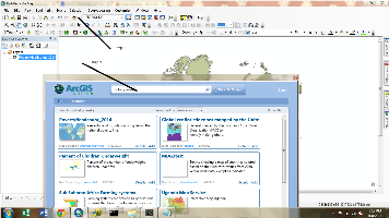
1)In ArcMAP select "Add Data From ArcGIS Online"

2) In the search window that appears "global poverty" without quotes

Global Poverty

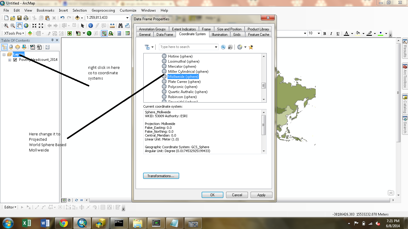
Change the projection to Mollweide using this image Cnage to Mollweide

Then hit okay to any warning that appear

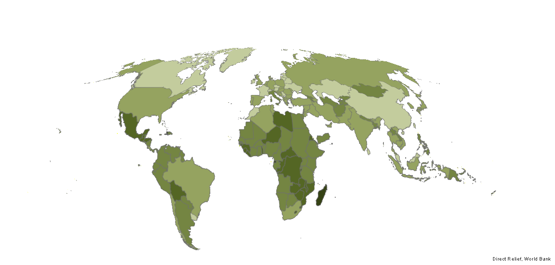
this is how it looks. enter image description here

Your Answer

By clicking “Post Your Answer”, you agree to our terms of service and acknowledge you have read our privacy policy.

Not the answer you're looking for? Browse other questions tagged or ask your own question.