0

I am trying to represent data using bins as the data was too large to display each and every point simultaneously.
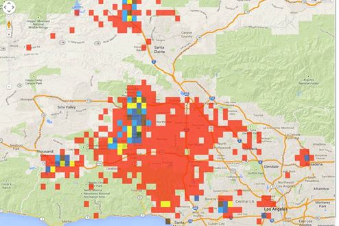
enter image description here

The problem with this also existing if the no of bins are getting larger than 15K, map hangs while zooming in and zooming out.

So I thought of using WMS, I am new to this, I have set up GeoServer, but confused how to add layer to this and how to access that layer.

Can I add layer dynamically to GeoServer as the scenario is: User Uploads a geopoints information file and then views the data in that file.

I am creating a GeoJSON data format from the uploaded file of user. So is it possible to upload that GeoJSON data as a layer at runtime with GeoServer and then ready to view.

Is the huge data representation possible using OpenLayers?

2
  • Hi and welcome to GIS stack exchange. Please take a quick look at the site tour - you need to rephrase this as two separate questions. You should also do a quick Google search on "Google Maps WMS GeoServer" as this has been answered elsewhere already Commented Jun 11, 2014 at 5:55
  • only .shp files can be used for datasource of layer in geoserver or any other datasource also.. if yes then can i provide geojson data in a txt file as a datasource. if no then can i convert geojson data in to shp file – Commented Jun 12, 2014 at 3:58

2 Answers 2

1

yes, you can upload data dynamically to GeoServer, e.g. using REST API http://docs.geoserver.org/2.0.0/user/extensions/rest/index.html

Yes, you can use latest OpenLayers 2 or better Leaflet or OpenLayers 3 for displaying really BIG amounts of vector data. For OpenLayers 2, use CANVAS as renderer, not DOM. Leaflet or OpenLayers 3 are using canvas by default.

Consider using TopoJSON instead of GeoJSON - the amount of data to be transferred is significantly smaller.

1
  • only .shp files can be used for datasource of layer in geoserver or any other datasource also.. if yes then can i provide geojson data in a txt file as a datasource. if no then can i convert geojson data in to shp file Commented Jun 12, 2014 at 3:56
1

Geoserver as of v2.6 supports direct upload of GeoJSON in ESPG:4236 projection... https://github.com/GeoNode/geonode/pull/2155

If your going that route; however if this is a one time thing you might want to consider an open source node.js application called mapshaper - http://www.mapshaper.org/ you can easily host your own as a server side nodejs deployment

Your Answer

By clicking “Post Your Answer”, you agree to our terms of service and acknowledge you have read our privacy policy.

Not the answer you're looking for? Browse other questions tagged or ask your own question.