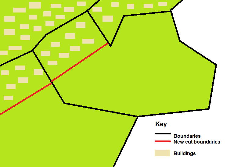
I have two layers:
Polygon layer representing administrative boundaries
Polygon layer representing topography (i.e. a map)
In some of the administrative areas, the buildings (shown in the map) are grouped in one area while the rest of the area is something else. I would like to split the administrative area into two, one containing all the buildings and another containing no buildings. See diagram.

I created a union between my two layers and then dissolved to create a third layer which identified the "building/not building" for each administrative area, this is close to what I want except that it doesn't create a single cut, but creates a complex shape that wraps around each building and go along roads etc.
I have a few thousand polygons like this so I would like to be able to cut them automatically.
