2

I did an supervised classification for for this watershed. The attribute table doesn't have the count for total number of cell for each classification. I've created a field titled 'Count' with type 'Long', but I haven't figured out how to populate it. The photo is just to better illustrate what I'm trying to do.

-Using ArcGIS 10.1

-Supervised classification done on Landsat7 images that had multiple bands. I don't know why the table has a red, green, and blue column
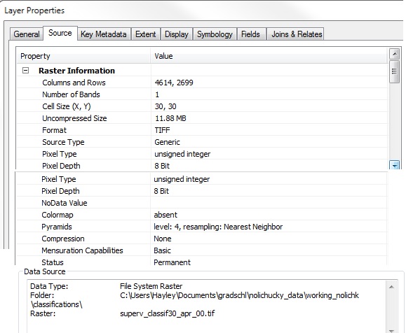
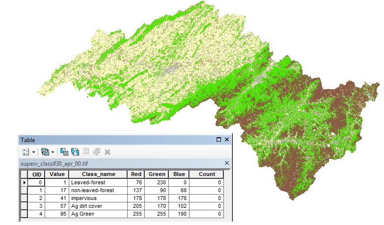
Raster properties for the supervised classification imageAttribute table I'm working with

7
  • 1
    How is it that the attribute table showing Red/Green/Blue values, when the output of classification approaches is a single band data.?
    – Akhil
    Commented Jan 9, 2015 at 3:50
  • In which software have u done your classification?
    – Learner
    Commented Jan 9, 2015 at 6:14
  • If this was an Integer grid you would have a Value and Count column. I fear you are not telling us the whole story as pointed out by @Akhil an @msi_g!
    – Hornbydd
    Commented Jan 9, 2015 at 10:05
  • Normally ERDAS generates these RGB colums. If i got you workaround is get the area for each class and divide this area by cell size(spatial resolution)-this is the number of cell for that class.
    – Learner
    Commented Jan 9, 2015 at 12:00
  • @msi_g as stated in the question I'm using ArcGIS 10.1. I'm trying to find the area of the different classes. I just asked about the cell number because I thought that was the only way to find the area for each class. If you know of another way of getting the area of the classes I'd much appreciate it.
    – Hgotwald
    Commented Jan 9, 2015 at 16:18

2 Answers 2

4

I can't explain why your original raster does not have a populated count field - I thought it appeared by default for integer rasters.

In any case, you can get those values by:

  1. Create a new integer raster, from your original, using Int. This will create a copy of the raster with Value and Count fields.
  2. Join the new raster back to the original raster based on the Value fields in each.
0

I experienced this recently while using ArcGIS Pro (3.0.4). It may work for older versions of ArcGIS. Classified raster attribute tables failed to display the "Count" column. This was resolved by using the "Build Raster Attribute Table" tool.

Your Answer

By clicking “Post Your Answer”, you agree to our terms of service and acknowledge you have read our privacy policy.

Not the answer you're looking for? Browse other questions tagged or ask your own question.