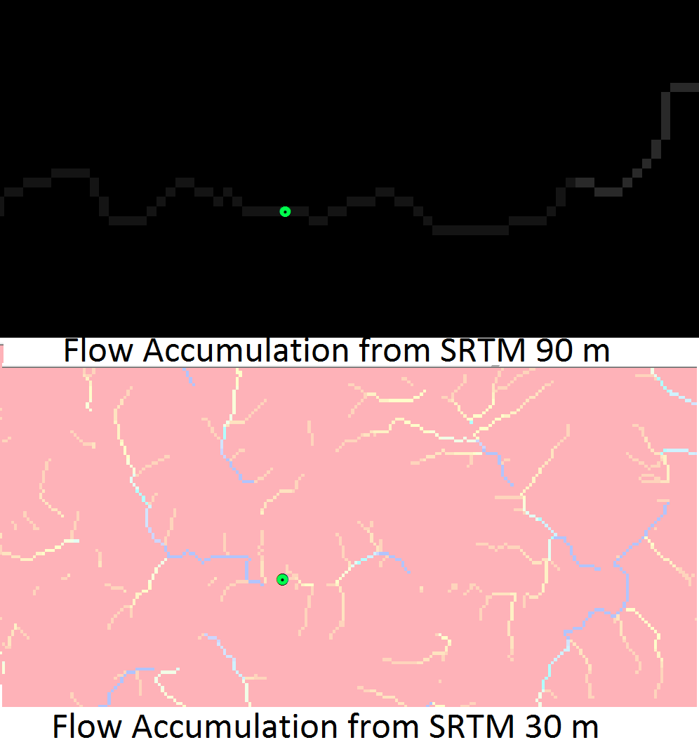
I have used SRTM 90 m in many of my hydrology projects for creating watershed and so far it has proven its worthiness. But, I haven't had any luck with its newer and high resolution SRTM 30 m prodigy. I have attached an image comparing flow accumulation maps created from both these sources for same location. As can be seen in the image, the flow accumulation model from 90 m is consistent and gives results as opposed to 30m in which there is discontinuity in the flow network. I was wondering if there is some workaround for this situation.
1 Answer
What software are you using? Are you running this calculation in a mountainous area? Especially in alpine areas, shadows and complex (steep) topology often produces "holes" in the data produced by SRTM. These were not corrected in the final data source and will mess up hydrological calculations.
Be sure your 30m SRTM DEM is free of errors. They are notorious for producing discontinuous watershed results if the data is not pre-processed.
You can see in most of the papers below, the SRTM data needed to be processed, generally with hole-filling (fill command in ArcGIS) and null value replacement in order for hydrological calculations to run properly.

