3

I have a calculated raster file, overlayed on a shapefile with lines (like on figure) Raster and polyline shape
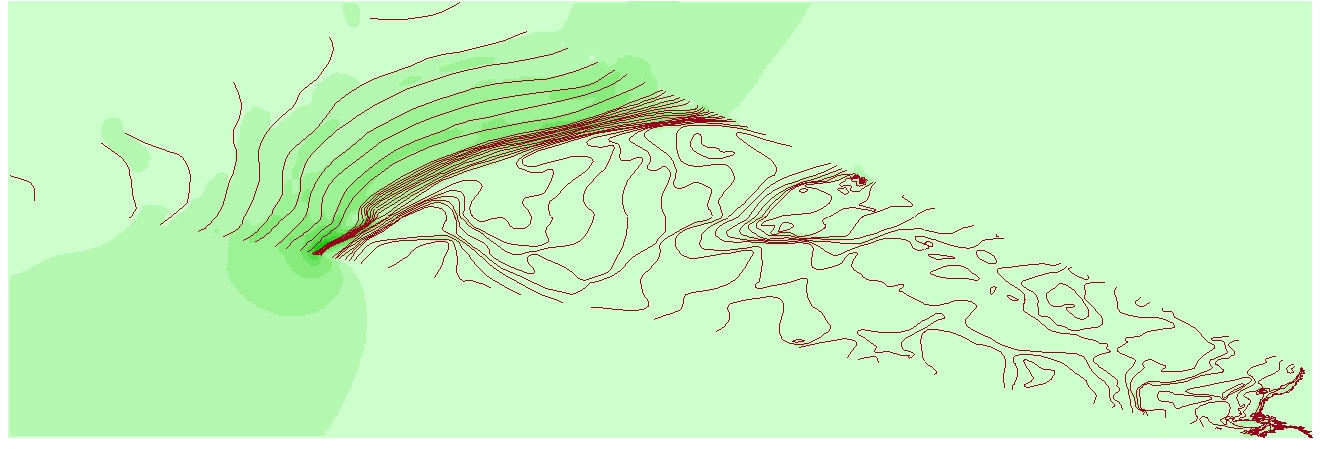
I would like to clip the raster in ArcMap (since it is an interpolation and out of the vector shape it is mostly meaningless) to the extent, where the available data are on vector shape (on figure this is a clearly seen wedge or triangle, where the lines are present only). Of course, this can be done manually drawing appropriate polygon around the vector file. But the question is, whether it is possible to derive automatically a polygon mask from this vector layer for clipping the raster? The standard tools seem to suggest only clipping around a rectangular area, containing whole vector data.

2
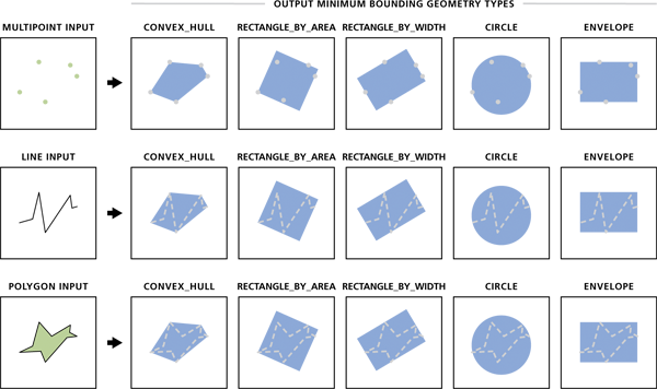
  • Minimum bounding geometry help.arcgis.com/en/arcgisdesktop/10.0/help/index.html#//… should work. This creates a convex polygon enclosing all your contour lines then using Extract by Mask (SA) you should be able to extract the common part. Commented Dec 13, 2015 at 23:37
  • 1
    I believe that had you set the processing extent or mask in geoprocessing options to the contours layer when you originally created the raster, the output would have been constrained to where the contours are to start with, rather than having to clip it later. I'm pretty sure I've used that to limit things to non-rectangular bounds before.
    – Chris W
    Commented Dec 14, 2015 at 4:18

1 Answer 1

4

I would recommend using Minimum Bounding Geometry (Data Management) followed by Clip (Data Management) with the clipping geometry option or Extract by Mask (Spatial Analyst).

enter image description here

1
  • 2
    I could support that approach Aaron. It's what I would do. Commented Dec 13, 2015 at 23:39

Your Answer

By clicking “Post Your Answer”, you agree to our terms of service and acknowledge you have read our privacy policy.

Not the answer you're looking for? Browse other questions tagged or ask your own question.