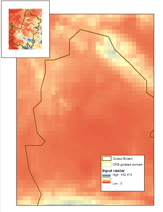
I am trying to clip the raster shown below (blue to red color scheme; inset shows zoomed out extent) to the polygon outlined in brown:
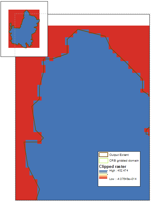
I want the clipped raster to match the exact shape of the polygon (i.e. to maintain the clipping extent). When I use the "Clip" tool, however, I have three problems (shown in the zoomed-in figure below): (1) the new raster does not maintain the clipping extent, or rather the individual grid cells maintain the box shape on the edges rather than clipping to the exact shape of the output extent, (2) the raster values are simplified to two values (red and blue), and (3) rather than clipping the edges, it appears that these raster were assigned a negative value.
I tried all combinations of the different “Clip” tool options, including checking and unchecking the two boxes, “Use Input Features for Clipping Geometry” and “Maintain Clipping Extent”. I tried a Google search but could not find a solution. I also checked that the input raster and the output extent are in the same spatial reference (both GCS_WGS_1984 with no projection). I also added the output extent as the "mask" option in "Geoprocessing > Environments > Raster Analysis".
Does anyone have any clues to why this may be and how to clip the input raster to the output extent (1) with the clipping extent boundaries maintained, (2) preserving the full spectrum of raster values, and (3) actually clipping the edges.


