1

I am trying to clip the raster shown below (blue to red color scheme; inset shows zoomed out extent) to the polygon outlined in brown:

enter image description here

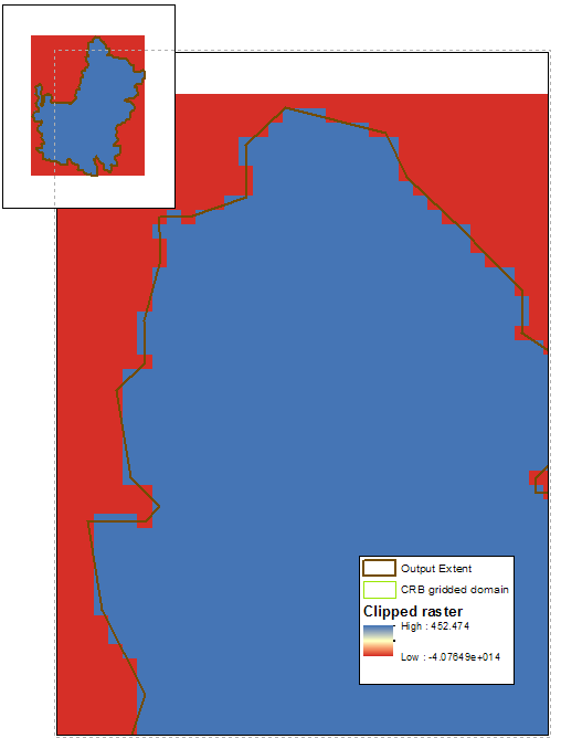
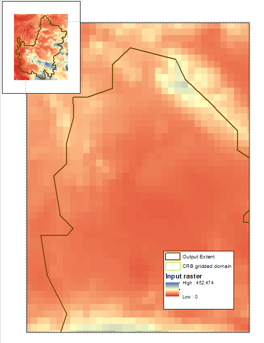
I want the clipped raster to match the exact shape of the polygon (i.e. to maintain the clipping extent). When I use the "Clip" tool, however, I have three problems (shown in the zoomed-in figure below): (1) the new raster does not maintain the clipping extent, or rather the individual grid cells maintain the box shape on the edges rather than clipping to the exact shape of the output extent, (2) the raster values are simplified to two values (red and blue), and (3) rather than clipping the edges, it appears that these raster were assigned a negative value.

enter image description here

I tried all combinations of the different “Clip” tool options, including checking and unchecking the two boxes, “Use Input Features for Clipping Geometry” and “Maintain Clipping Extent”. I tried a Google search but could not find a solution. I also checked that the input raster and the output extent are in the same spatial reference (both GCS_WGS_1984 with no projection). I also added the output extent as the "mask" option in "Geoprocessing > Environments > Raster Analysis".

Does anyone have any clues to why this may be and how to clip the input raster to the output extent (1) with the clipping extent boundaries maintained, (2) preserving the full spectrum of raster values, and (3) actually clipping the edges.

5
  • Because you are clipping a raster to a vector you need to use this tool: Data Management Tools -> Raster -> Raster Processing -> Clip
    – NULL.Dude
    Commented May 25, 2017 at 19:02
  • 2
    2) The jagged edges are normal, raster data is composed of grid cells and clipping them with a polygon will clip to the nearest grid cell, it won't split up a cell. If you want cleaner edges, you would need to start with a higher-resolution raster.
    – Dan C
    Commented May 25, 2017 at 19:03
  • Using a Mask here could also be helpful. But, I believe Dan has the right idea on this one
    – Reisenrich
    Commented May 25, 2017 at 19:19
  • Ok perhaps the edges cannot be cleaner at this resolution. Do you have any suggestions for resolving issues 2 and 3? Thanks for your help!
    – Kristen
    Commented May 25, 2017 at 21:31
  • keep in mind that rasters are rectangles or squares. said that, you cannot obtain a raster with a different shape. That is the answer for you number 3 question: everything outside the clipped area is given a "null" value, and "null" values will fill the raster until it reaches a rectangular or squared shape.
    – Vale
    Commented May 26, 2017 at 10:35

1 Answer 1

1

You can use Resample tool from ArcGIS -> ArcToolbox -> Data Management Tools -> Raster -> Raster Processing -> Resample to change (increase) the spatial resolution of your image. Increasing spatial resolution means reducing the cell/pixel value.

For example, if the spatial resolution of the image is 90 m, you can use Resample tool to make it 30 m. But you need to be careful of choosing a proper pixel value as it will increase the image size of the resampled image.

Your Answer

By clicking “Post Your Answer”, you agree to our terms of service and acknowledge you have read our privacy policy.

Not the answer you're looking for? Browse other questions tagged or ask your own question.