2

I'm using ArcGis 10.2, I have photos in .jpeg that are geotagged with lat/long. I'm using Data Management Tools > Photos > GeoTagged Photos to Points tool in the ArcToolbox. So far I have been able to get it to successfully import the photo locations as points onto my map. However I would like to include the photos as attachments so that when I click on the individual point I can see the photo it represents.

On the tool pop up, there is the option to check "Add Photos As Attachments" but I can't select it. It's grayed out and when I click on it the message on the side of the popup reads: "the output feature class must be in a version 10 or higher geodatabase for photo files to be added as attachments".

I'm not sure what it means by a version 10 or higher geodatabase. The output feature class sections fills out automatically to the ArcGIS folder on my E drive. I've tried changing it so that it's the same folder as the input folder but I still can't select the "Add Photos" option. Has anyone else had this issue and/or does someone know what it means by my choice of geodatabase?

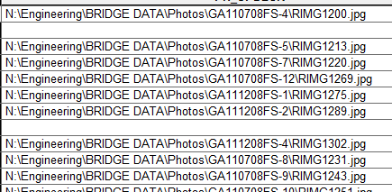
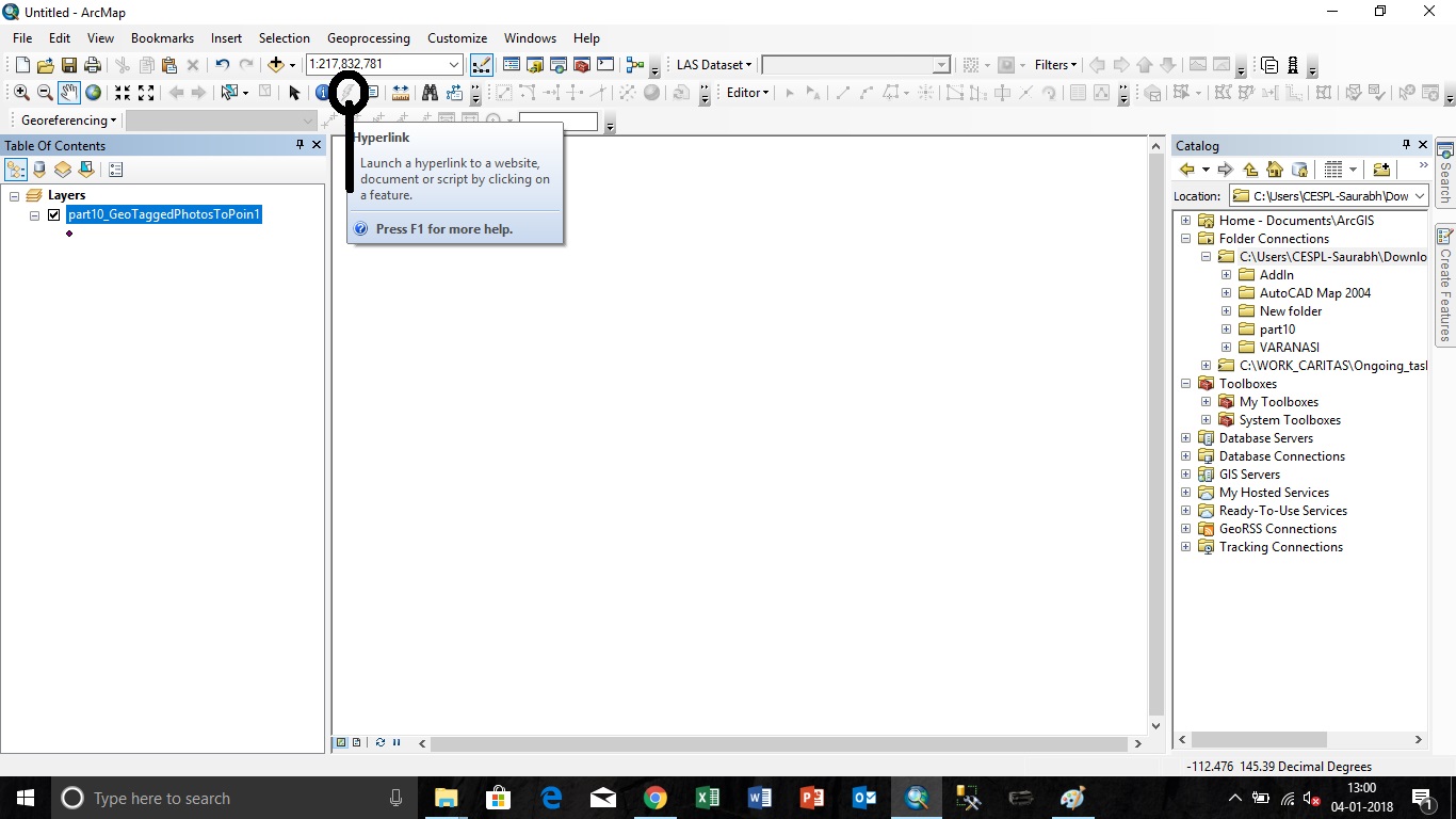
Update: I was able to find a solution that produced different but similar results. I enabled hyperlinks in the properties of the point shapefile for the photos. If I use the hyperlink tool (little lightning bolt) and click on an individual point the actual picture opens in a photo viewer on my computer. So the links to the network are working and I can see which photo corresponds with which point (ultimately what I needed) but I would still like to see if I can find a way to add photos as attachments as mentioned above.

1
  • Yes I have had simuliar issues with a project I just worked on for work. I needed video clips to appear associated with specific points on my map. The only way I could get it to work is to hyperlink them. I read something about being able to add more than one path to the hyperlink so you could show multiple videos (photos in your case) but havent found a solution for that.
    – NULL.Dude
    Commented Oct 19, 2016 at 18:28

4 Answers 4

2

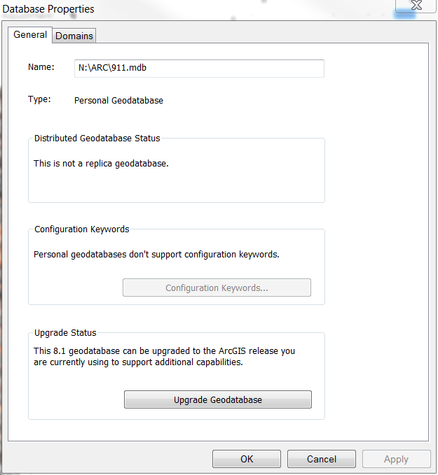
It sounds like the simple thing would be that the database was created in (or created for use with) an older version of ArcMap. You can right-click the geodatabase in ArcCatalog and select "Properties" from the context menu. Then you conveniently have the ability to "Upgrade the Database" right there (you may wish to make a backup if someone else is using the database and needs that older version).

EDIT: Of course the simple thing may not always be the solution (despite Occam's Razor). After reading your first comment to my Answer, I'd suggest that something buggy is going on. Can you try to put your feature class into a new GeoDatabase that you create? Sometimes having a fresh working environment takes care of buggy things like that. That error seems to be incorrect since you are using 10.2 and the requirement is that the database be 10.0+.

GeoDatabase Properties

That by itself my take care of the issue for you. I've not done attachments but have done the hyperlinks to the photos sitting on the network. Each file has a link as shown in this second screenshot and you use the Hyperlink Tool to bring up the images. Hope that helps!

Second Screenshot

2
  • I opened my current database properties and wasn't given the option to update unfortunately. The pop-up (which look just like yours) said "This geodatabase matches the ArcGIS release you are currently using." Also I was able to use the hyperlink tool and select each point to open up a small pop-up with each the individual photo's info (similar to the attributes table) including link to location on the network, but I'd like to try and include the actual photos in this as well.
    – Struggling
    Commented Dec 15, 2015 at 14:55
  • Hm, I created a new file geodatabase and selected that as the output feature class. I'm still unable to select "add photos as attachments". The new geodatabase also "matches the ArcGIS release you are currently using". I might try opening a fresh ArcMap and seeing if it's this particular file or something.
    – Struggling
    Commented Dec 15, 2015 at 16:00
1

I have encounter the same issue.

My solution:

  1. Created a geodatabase within the same folder of the geo-tagged photos.
  2. On the "GeoTagged Photos To Point" ArcTools window - Under "Output Feature Class" - Select the geodatabase and name your feature class accordingly. By doing so, you will be able to check the box on the "Add Photos As Attachments"
1

This is very simple using Arcmap.

This can be done in 4 easy step.

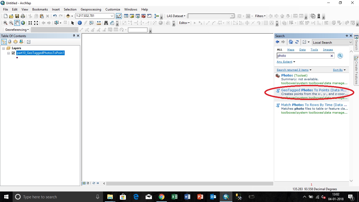
Step 1.) Use "GeoTagged Photos to Points" tool to make point feature for the georeferenced images as mentioned in the screenshot below: enter image description here

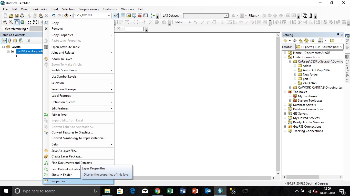
Step 2.)Open the "Properties" of the newly created point shapefiles as per the screenshot below: enter image description here

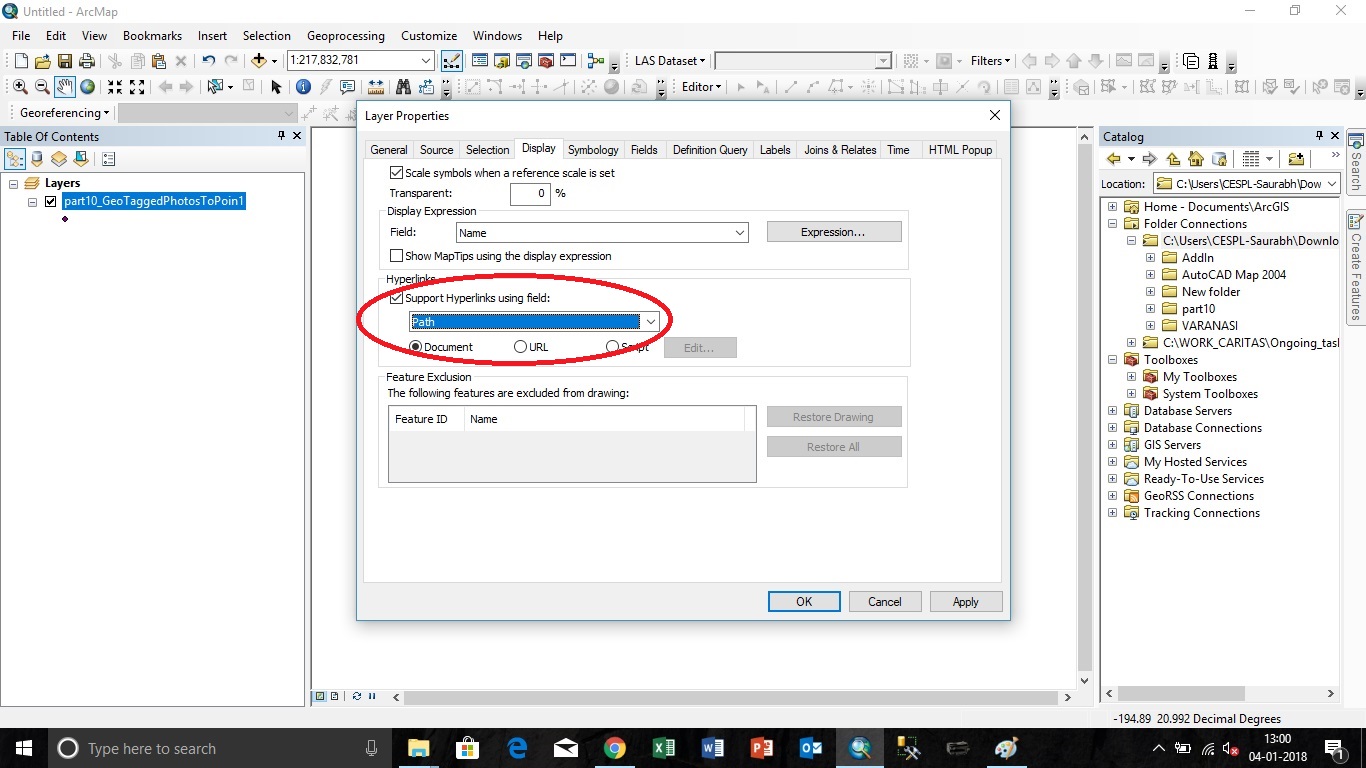
Step 3.) Go to "Display" tab and tick the check box "Support Hyperlinks using field" and select the field as "Path" and click OK as per the screenshot below: enter image description here

Step 4.) Finally click the hyperlink button as per the screenshot below and click the point feature for which you want to see the photo. enter image description here

Thanks

0

I'm pretty sure the Add Photos As Attachments feature is only available with Standard licence or above. Did you figure out a solution?

Your Answer

By clicking “Post Your Answer”, you agree to our terms of service and acknowledge you have read our privacy policy.

Not the answer you're looking for? Browse other questions tagged or ask your own question.