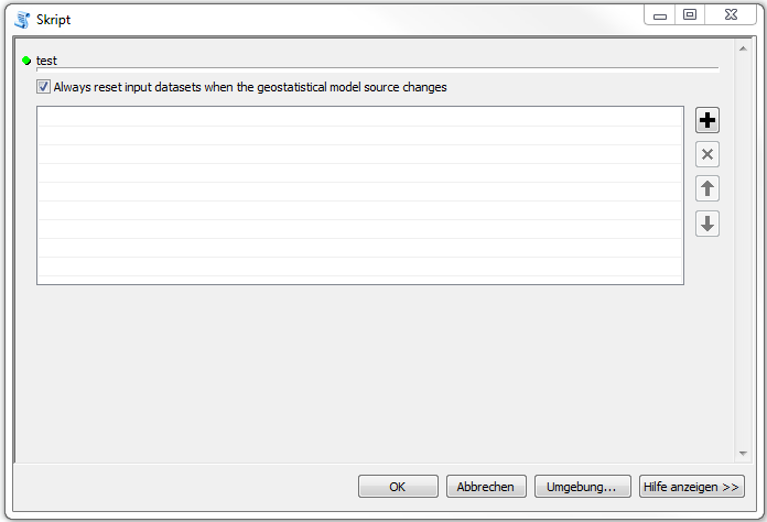
I am trying to implement a Python Script tool where I need a table to input shapefiles and corresponding names for new created fields.
I found out that there is the Value Table provided by ArcGIS, but using the "Geostatistical Value Table" as data type in the properties of the script, it does not appear correctly in the user interface, see attachment where I just made a small test.
The tool is a python script tool (*.tbx) and the geostatistical analyst extension is enabled. My code so far includes only the Import Statements and Statements to read out the Parameter.
import arcpy
inputShp = arcpy.GetParameterAsText(0)
Then I passed on the the script to a custom toolbox and added the Parameter where I chose Geostatistical Value Table as data type.
After finishing the wizard, I can open the tool, but as you can see from the figure, it seems that there is too few space below test to enter a shapefile.
It should look somehow like in this example, right: Creating a ValueTable with a column that has dependency


Python Script tool (*.tbx)or aPython Toolbox tool (*.pyt), please? Either way, for help with ArcPy questions you should normally include a code snippet to illustrate what you have tried and where you are stuck. Are you using the GeoStatistical Analyst extension? If not, I suspect that you are using the wrong data type.