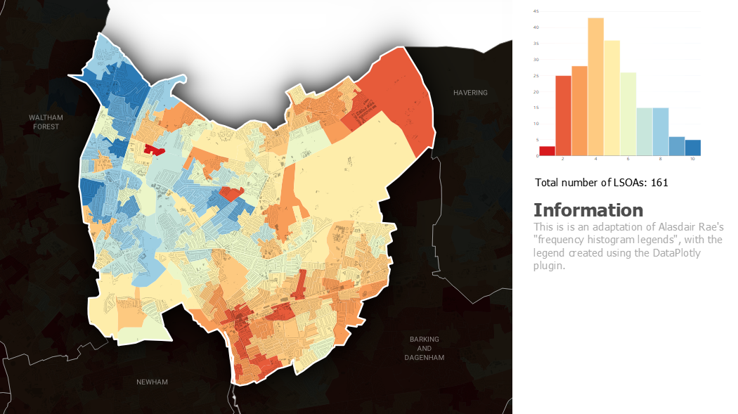
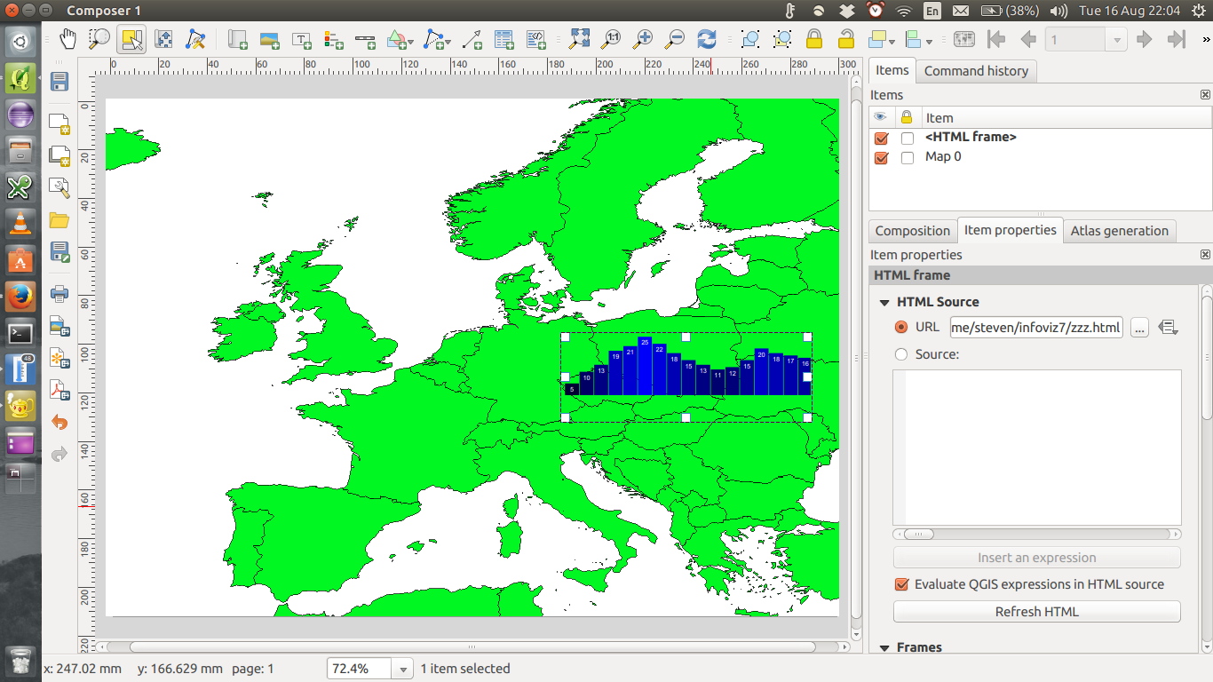
The DataPlotly plugin is getting there.
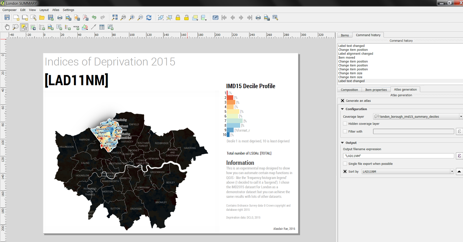
Instead of scaling rectangles using percentage values from a field precalculated using an external tool (Excel was used in the linked blog post), DataPlotly allows you to calculate histograms of the Atlas features directly:

I've added the configuration XML for the DataPlotly object at the end of this answer.
In Plotly histograms all bars have the same colour. To get individually coloured bars, I had to mangle a legend object (10 columns, replace all legend entry texts with spaces, remove all spacing, carefully adjust the height and width of the symbols, ...) and place it over the histogram using the "Screen" blending mode.
Some things don't yet work using DataPlotly
- Horizontal bars while specifying the axis limits
- Labelling every bar
- Adjusting the label fonts
- Removing/adjusting the grid lines
The DataPlotly plugin is under active development, so some of these issues may be resolved in the future.
DataPlotly configuration file configuration.xml
<?xml version="1.0" encoding="UTF-8"?>
<!DOCTYPE dataplotly>
<Option type="Map">
 <Option type="Map" name="dynamic_properties">
  <Option type="QString" name="name" value=""/>
  <Option name="properties"/>
  <Option type="QString" name="type" value="collection"/>
 </Option>
 <Option type="Map" name="plot_layout">
  <Option type="QString" name="additional_info_expression" value=""/>
  <Option type="QString" name="bar_mode" value="group"/>
  <Option type="double" name="bargaps" value="0"/>
  <Option type="bool" name="bins_check" value="true"/>
  <Option type="bool" name="legend" value="false"/>
  <Option type="QString" name="legend_orientation" value="h"/>
  <Option type="invalid" name="legend_title"/>
  <Option type="Map" name="polar">
   <Option type="Map" name="angularaxis">
    <Option type="QString" name="direction" value="clockwise"/>
   </Option>
  </Option>
  <Option type="Map" name="range_slider">
   <Option type="int" name="borderwidth" value="1"/>
   <Option type="bool" name="visible" value="false"/>
  </Option>
  <Option type="QString" name="title" value=""/>
  <Option type="invalid" name="x_inv"/>
  <Option type="double" name="x_max" value="10.5"/>
  <Option type="double" name="x_min" value="0.5"/>
  <Option type="QString" name="x_title" value=""/>
  <Option type="QString" name="x_type" value="linear"/>
  <Option type="invalid" name="xaxis"/>
  <Option type="invalid" name="y_inv"/>
  <Option type="invalid" name="y_max"/>
  <Option type="invalid" name="y_min"/>
  <Option type="QString" name="y_title" value=""/>
  <Option type="QString" name="y_type" value="linear"/>
  <Option type="QString" name="z_title" value=""/>
 </Option>
 <Option type="Map" name="plot_properties">
  <Option type="invalid" name="additional_hover_text"/>
  <Option type="int" name="bins" value="10"/>
  <Option type="QString" name="box_orientation" value="v"/>
  <Option type="bool" name="box_outliers" value="false"/>
  <Option type="bool" name="box_stat" value="false"/>
  <Option type="invalid" name="color_scale"/>
  <Option type="bool" name="color_scale_data_defined_in_check" value="false"/>
  <Option type="bool" name="color_scale_data_defined_in_invert_check" value="false"/>
  <Option type="QString" name="cont_type" value="fill"/>
  <Option type="QString" name="contour_type_combo" value="Fill"/>
  <Option type="bool" name="cumulative" value="false"/>
  <Option type="List" name="custom">
   <Option type="QString" value="IMDD15"/>
  </Option>
  <Option type="QString" name="hover_text" value="all"/>
  <Option type="QString" name="in_color" value="#000000"/>
  <Option type="bool" name="invert_color_scale" value="false"/>
  <Option type="QString" name="invert_hist" value="increasing"/>
  <Option type="QString" name="line_combo" value="Solid Line"/>
  <Option type="QString" name="line_dash" value="solid"/>
  <Option type="QString" name="marker" value="markers"/>
  <Option type="double" name="marker_size" value="10"/>
  <Option type="int" name="marker_symbol" value="0"/>
  <Option type="QString" name="marker_type_combo" value="Points"/>
  <Option type="double" name="marker_width" value="1"/>
  <Option type="QString" name="name" value="IMDD15"/>
  <Option type="QString" name="normalization" value=""/>
  <Option type="double" name="opacity" value="1"/>
  <Option type="QString" name="out_color" value="#ffffff"/>
  <Option type="QString" name="point_combo" value=""/>
  <Option type="bool" name="selected_features_only" value="false"/>
  <Option type="bool" name="show_colorscale_legend" value="false"/>
  <Option type="bool" name="show_lines" value="false"/>
  <Option type="bool" name="show_lines_check" value="false"/>
  <Option type="bool" name="show_mean_line" value="false"/>
  <Option type="bool" name="violin_box" value="false"/>
  <Option type="QString" name="violin_side" value="both"/>
  <Option type="bool" name="visible_features_only" value="true"/>
  <Option type="QString" name="x_name" value="IMDD15"/>
  <Option type="QString" name="y_name" value=""/>
  <Option type="QString" name="z_name" value=""/>
 </Option>
 <Option type="QString" name="plot_type" value="histogram"/>
 <Option type="QString" name="source_layer_id" value="london_IMD_2004_2010_2015_081015_v120160214112646566"/>
</Option>


