3

I'm a python-qgis beginner.

I use to work with multi-band rasters. Each raster is made of images coming from satellite sensors acquired in different dates and stacked in order to build a multi temporal dataset.

Is it possible to produce a raster layer in which each pixel has the minimum value that this pixel reaches in all the bands?

I mean, it is possible to produce the "layer of temporal minimum" of the multi-band raster?

1
  • 1
    I'd use GDAL (part of QGIS). There is an example of getting the statistics pcjericks.github.io/py-gdalogr-cookbook/raster_layers.html (search for GetStatistics), you will need to do this for each band, from there create a raster of the same size, copy the geotransform and write the minimum value obtained from the statistics. Is that approximately what you're trying to do or are you trying to get the minimum of each cell in all the bands? Commented Sep 14, 2016 at 23:05

1 Answer 1

2

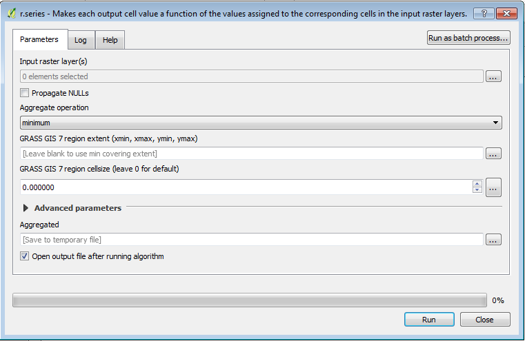
The tool you are looking for in QGIS is called r.series (GRASS GIS) using a minimum statistic. This is also available as a command line utility.

r.series - Makes each output cell value a function of the values assigned to the corresponding cells in the input raster map layers.


Processing Toolbox > GRASS GIS > Raster > r.series

enter image description here

1
  • Thank you very much users. I'm trying to get skilled with python GDAL. I didn't the GRASS tool. Looks very useful for me
    – ilFonta
    Commented Sep 15, 2016 at 8:42

Your Answer

By clicking “Post Your Answer”, you agree to our terms of service and acknowledge you have read our privacy policy.

Not the answer you're looking for? Browse other questions tagged or ask your own question.