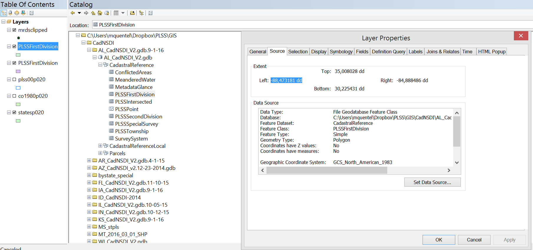
I am trying to create a layer from a feature class that exists within a feature dataset within a geodatabase. Using the interface, I can simply add data and click through the gdb and the feature data set, so I know the data does exist.
When I try to do the same in ArcPy, using this code
import arcpy
arcpy.env.workspace = r"C:\Users\mquentel\Dropbox\PLSS\GIS"
arcpy.MakeFeatureLayer_management(r"\CadNSDI\AL_CadNSDI_V2.gdb.9-1-16\AL_CadNSDI_V2.gdb\CadastralReference\PLSSFirstDivision", "Sections")
it gives out error 000732 data set does not exist or is not supported
Following Vince's advice I have run the same code without the feature data set in the path (see below) but it returns the same error.
arcpy.MakeFeatureLayer_management(r"\CadNSDI\AL_CadNSDI_V2.gdb.9-1-16\AL_CadNSDI_V2.gdb\PLSSFirstDivision", "Sections")
Using the advice from Constructing file path within Python for Feature Class within Feature Dataset?, I checked whether the file existed:
print(arcpy.Exists(r"C:/.../AL_CadNSDI_V2.gdb/CadastralReference/PLSSFirstDivision"))
where CadastralReference is the name of the feature dataset and PLSSFirstDivision is the name of the feature class as specified when checking the layer's properties and it gives out False (i.e. the data does not exist).
Here is a screenshot of the catalog as well as of the layer's properties I get if I add the data manually through the interface.
I have tried backslashes (with r), forwardslashes and also joining paths using os.join and the names of the feature dataset and class.
Where am I making the mistake?


