Some time ago I wrote a post for creating a vector grid of polygons:
How to generate a vector grid of polygons in QGIS using Python
which inspired me for proposing a solution.
My approach recurs to a custom script from the Processing Toolbox (please, refer to the above post if you don't know how to do it).
As input parameters, it requires:
- the point vector layer;
- the extent of the grid;
- the horizontal spacing, i.e. the horizontal side length for the features in the grid;
- the vertical spacing, i.e. the vertical side length for the features in the grid.
Assuming that the download speeds are stored in the "download_speed" field,
you may use this code:
##Point_layer=vector point
##Grid_extent=extent
##Horizontal_spacing=number 10
##Vertical_spacing=number 10

from qgis.core import *
from qgis.PyQt.QtCore import QVariant
from PyQt4.QtGui import QColor

layer = processing.getObject(Point_layer)
crs = layer.crs().toWkt()

extent = Grid_extent.split(',')
(xmin, xmax, ymin, ymax) = (float(extent[0]), float(extent[1]), float(extent[2]), float(extent[3]))
hspacing = Horizontal_spacing
vspacing = Vertical_spacing

# Create the grid layer
vector_grid = QgsVectorLayer('Polygon?crs='+ crs, 'vector_grid' , 'memory')
prov = vector_grid.dataProvider()

all_features = {}
index = QgsSpatialIndex() # Spatial index
for ft in layer.getFeatures():
    index.insertFeature(ft)
    all_features[ft.id()] = ft

# Add ids and coordinates fields
fields = QgsFields()
fields.append(QgsField('ID', QVariant.Int, '', 10, 0))
fields.append(QgsField('XMIN', QVariant.Double, '', 24, 6))
fields.append(QgsField('XMAX', QVariant.Double, '', 24, 6))
fields.append(QgsField('YMIN', QVariant.Double, '', 24, 6))
fields.append(QgsField('YMAX', QVariant.Double, '', 24, 6))
fields.append(QgsField('Color', QVariant.String, '', 10))
prov.addAttributes(fields)

# Generate the features for the vector grid
id = 0
y = ymax
while y >= ymin:
    x = xmin
    while x <= xmax:
        point1 = QgsPoint(x, y)
        point2 = QgsPoint(x + hspacing, y)
        point3 = QgsPoint(x + hspacing, y - vspacing)
        point4 = QgsPoint(x, y - vspacing)
        vertices = [point1, point2, point3, point4] # Vertices of the polygon for the current id
        inAttr = [id, x, x + hspacing, y - vspacing, y]
        tmp_geom = QgsGeometry().fromPolygon([vertices])
        idsList = index.intersects(tmp_geom.boundingBox())
        if idsList:
            tmp_list = [all_features[id]['download_speed'] for id in idsList]
            if max(tmp_list) <= 10:
                inAttr.append('Red')
            elif min(tmp_list) > 10:
                inAttr.append('Black')
            else:
                inAttr.append('Grey')
            feat = QgsFeature()
            feat.setGeometry(tmp_geom) # Set geometry for the current id
            feat.setAttributes(inAttr) # Set attributes for the current id
            prov.addFeatures([feat])
            id += 1
        x = x + hspacing
    y = y - vspacing

# Update fields for the vector grid
vector_grid.updateFields()

# define the lookup: value -> (color, label)
speeds_colors = {'Red': ('#e31a1c', 'Red'), 'Black': ('#000000', 'Black'), 'Grey': ('#82807f', 'Grey'),}

# create a category for each item in speeds_colors
categories = []
for speed_color, (color, label) in speeds_colors.items():
    symbol = QgsSymbolV2.defaultSymbol(vector_grid.geometryType())
    symbol.setColor(QColor(color))
    category = QgsRendererCategoryV2(speed_color, symbol, label)
    categories.append(category)
print categories
# create the renderer and assign it to the layer
expression = 'Color' # field name
renderer = QgsCategorizedSymbolRendererV2(expression, categories) # categorized symbol renderer
vector_grid.setRendererV2(renderer) # assign the renderer to the layer
vector_grid.triggerRepaint()

# Add the layer to the Layers panel
QgsMapLayerRegistry.instance().addMapLayer(vector_grid)
As an experienced Python user, you should be able to easily understand the above code and adapt it to your specific needs (otherwise, let me know if you need any explanation). One more thing: I didn't deeply test the conditionals for the assignment of colors, but it should be an easy task for you.
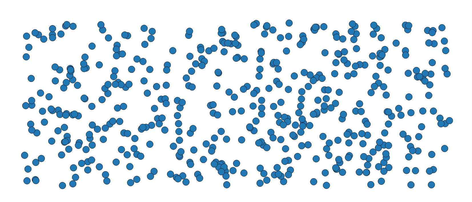
Testing the code on these random points:

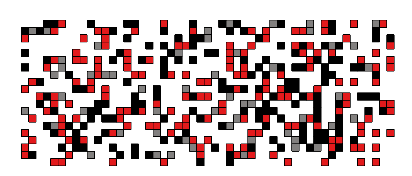
I obtain this result:

which seems to be what you are looking for.


