1

I have two raster files (lets call them raster A and B) and I would like to multiply them with the raster calculator. I keep getting an error message when working with the raster calculator. I thought it could be related to differences in resolution of the rasters. Raster A has a cell size of 25x25m and raster B of 0.00029444091x 0.00029444091 m.

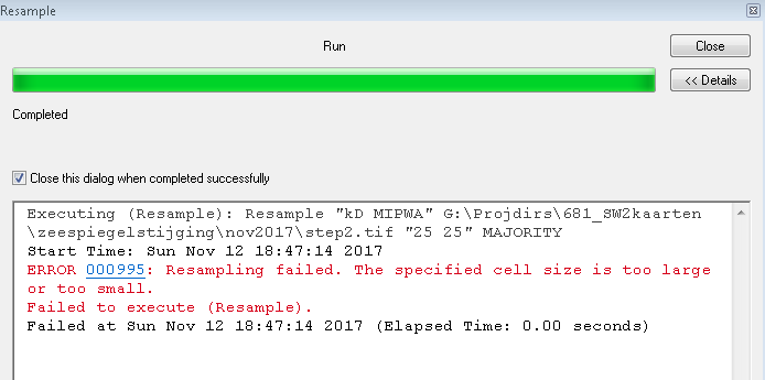
I wanted to change the small cell size so I tried the aggregate tool and the resample tool. It did not work. The resample tool gave the following error message:

enter image description here

Does someone has any ideas how to work with this? Are there any other tools available to change the resolution?

I am using ArcGIS 10.2.2

3
  • 4
    What spatial reference do the files have? With a cell size that small on the 2nd raster I would suggest a geographic spatial reference. If their spatial reference is currently undefined apply their correct spatial reference before attempting to aggregate with an output spatial reference, snap raster and extent of Raster A in your environment settings, this should put Raster B in the same spatial reference, origin and cell size as Raster A. Commented Nov 12, 2017 at 21:09
  • That worked perfectly! Thank you so much, and for your fast reply! the geographic spatial reference were different. But with the aggregate tool and the environmental settings as you mentioned (and cell factor = 1) the output raster matched. The raster calculation worked fine just now
    – A. Heij
    Commented Nov 13, 2017 at 21:34
  • 1
    Glad to help. Can you now answer your own question with screenshots and an explanation for future users with the same problem. Commented Nov 13, 2017 at 21:36

1 Answer 1

0

For the raster calculator to work without errors, the cell sizes of the raster should be the same, and pixel overlap positioned perfectly (not shifted).

To create a raster A with the same resolution as raster B, one can use the aggregate tool* (spatial Analyst) with the following settings: enter image description here

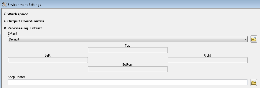
Before clicking OK, open the environments tab and adjust the settings for Processing extent and select raster B at the snap raster options and extent ("same as layer..")

enter image description here

Also select raster B in the cell size options at the tab Raster analysis ("same as layer..") .

*The aggregate tool generates a reduced-resolution version of a raster. Each output cell contains the Sum, Minimum, Maximum, Mean, or Median of the input cells that are encompassed by the extent of that cell.

Your Answer

By clicking “Post Your Answer”, you agree to our terms of service and acknowledge you have read our privacy policy.

Not the answer you're looking for? Browse other questions tagged or ask your own question.