The Esri docs for PostgreSQL data types supported in ArcGIS v10.6 says in part [emphasis added]:
If you create your geodatabase using the Create Enterprise Geodatabase geoprocessing tool, your database is created using a template other than the PostGIS template. Therefore, if you want to use the PostGIS geometry or geography type, you must create a database manually using the PostGIS template. Then you can specify your existing database when you run the Create Enterprise Geodatabase geoprocessing tool, and the geodatabase will be created in this PostGIS-enabled database.
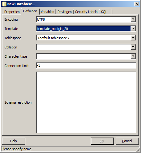
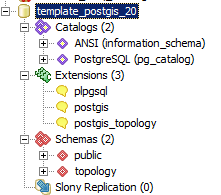
How exactly does one "create a db using the postgis template"?
We intend to use the postgres GEOGRAPHY type for GEOMETRY_STORAGE instead of the Esri default ST_GEOMETRY (ref).
I've installed Postgres 9.6 using the Esri supplied installer* and used Stack Builder to install PostGIS extension. I'm able to connect to Postgres with pgAdmin from a remote computer.
* PostgreSQL_DBMS_for_Windows_963_158796
update: fixed installed postgres version typos. Added ArcGIS version.


