2

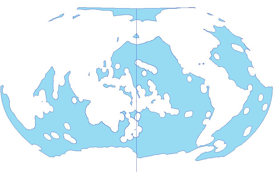
I have reprojected a file of global ocean zoning to Winkel III shifting the central meridian to -180 to center it on the Pacific using ArcGIS 10.5. Doing so, a gap at the dateline appears: enter image description here
In a closeup, it's actually a line and a gap: enter image description here
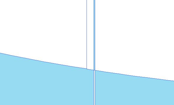
The whole file remains one polygon though. I've tried the Integrate tool but no success. I wonder which tool to use instead, if I am making a mistake regarding the reprojection or if there is any cosmetic fix to make the line disappear (but keep other outlines) in maps?

1
  • Did you try the Dissolve tool?
    – FSimardGIS
    Commented May 1, 2018 at 16:45

1 Answer 1

1

Normally I use this for a similar looking display issue East-West across the map, but you could try moving the wrap parameter the .prj file. (e.g. +lon_wrap=-180) See wrap parameter explanation here.

Edit:

I do this by creating a custom projection. Then you should be able to customize/write your own .prj file. See the documentation links for Arc and QGIS below.

Arc link // QGIS Link

4
  • Thank you for the suggestion. How would I move the wrap parameter? I am not familiar with Python in ArcGIS and cannot open the .prj in any meaningful way either.
    – Kristina
    Commented May 11, 2018 at 19:40
  • You can always open .prj using notepad and take a look at what's there 👍
    – Lisa
    Commented May 16, 2018 at 22:03
  • @Lisa your link to the wrap parameter is broken, can you fix it please?
    – Hornbydd
    Commented Apr 27, 2020 at 15:20
  • @Hornbydd updated the link
    – Lisa
    Commented May 11, 2020 at 16:54

Your Answer

By clicking “Post Your Answer”, you agree to our terms of service and acknowledge you have read our privacy policy.

Not the answer you're looking for? Browse other questions tagged or ask your own question.