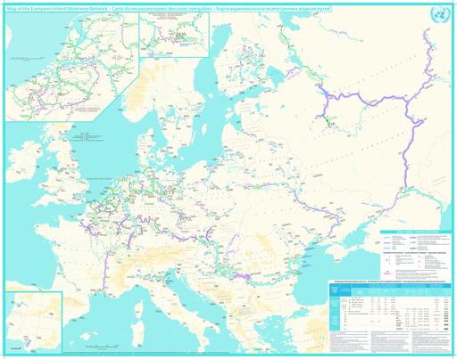
What you want is the projection, not the coordinate reference system. You need to look at the lines of longitude and latitude and work out from their curvature what possible projections it might be.
For example, the latitude lines are curved, which rules out anything like Mercator or Peters projection. Conic projections [https://en.wikipedia.org/wiki/Lambert_conformal_conic_projection] have straight lines of longitude and curved latitude - I'm having trouble eyeballing the straightness of the longitude lines but load it into a GIS or graphics package and see if the longitude lines are straight. That might indicate a conical projection. Then you need to figure out the parameters of the conic.
If all the lines are curved, you might have something like an azimuthal projection, and then you need to figure out the parameters of that - what's the projection centred on, and so on.
Sometimes its easier to georeference and warp an image to a known set of coordinates. With a good lat-long graticule on the image you know the true lat-long of a lot of points on the image, and you can use a "rubber sheet" deformation to warp the image to any other projection. The more reference points the better.

