I have two large polygon data-sets. One highlights the building footprints for a county and the other highlights the parcel boundaries for the same county. Some parcel polygon features have multiple building footprint polygons that are within the boundary of the parcel polygon. I want to take each individual building footprint polygon feature and join the parcel ID number to each building footprint feature that lies within the larger perspective parcel polygon feature it's located in. The actual exported feature I want in the end are the building footprint features with the parcel ID # in the attributes.
1 Answer
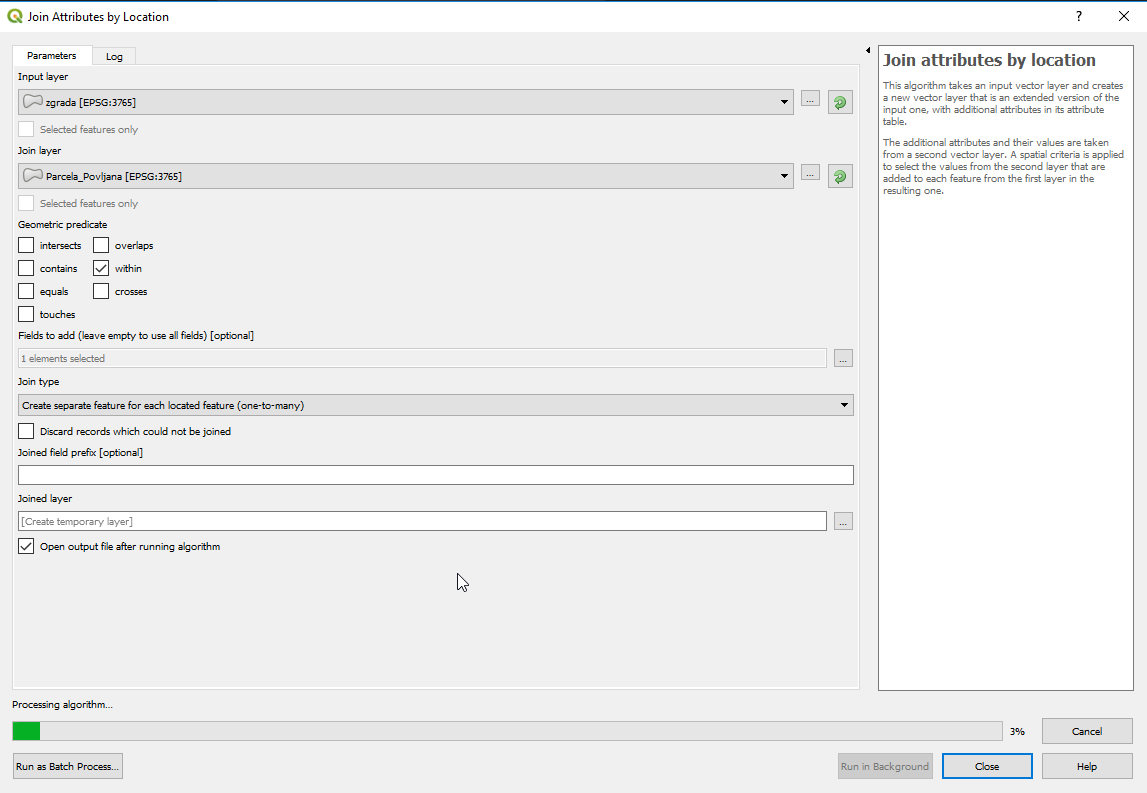
The tool you need is under: Vector/Data Management Tools/Join Attributes by Location
This algorithm takes an input vector layer and creates a new vector layer that is an extended version of the input one, with additional attributes in its attribute table. The additional attributes and their values are taken from a second vector layer. A spatial criteria is applied to select the values from the second layer that are added to each feature from the first layer in the resulting one.
-
Thanks Marin! Does the geometric predicate refer to the joined layer as "within" the input layer or is it the other way around? I am asking b/c the building footprints are actually smaller than the parcel polygons. So technically the parcel polygons are not within the building footprints but the building footprints are within the parcel polygons. Appreciate the clarification. Commented Sep 11, 2018 at 12:26
-
1If you want to detect what parcel your building is in, this works: input - building layer, join layer - parcel layer, geometry predicate - within, fields to add - parcel_id. This would add parcel ID to building attribute table. Commented Sep 11, 2018 at 12:39

