Problem Statement:
I am working on the project where machines are sending huge amount of lat/long data. Now I am drawing multiple days data on a map, it takes too much time to draw complete data on the map. We are saving data in Influxdb.
My Propose Solution
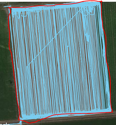
My solution is to only draw empty polygons on the map. I want to calculate/get boundaries of an area with latitude and longitude. I will save those boundaries lat/long in a separate table for fast rendering on the map. I will use those boundaries data to draw the polygon in google map.
Question
How to get red marked boundary of area, which is mentioned in below image. I would prefer a backend library so that my service can calculate these boundaries and save in Influxdb.

