0

I have a territory with supermarkets. I'd like to find the areas in this territory which has less than 3 supermarket in its vicinity. For that, I created a 1 mile buffer for each POI.

Is there a way to choose the areas in ArcGIS, which are overlayed by maximum 2 buffer zone?

2
  • 1
    Welcome to gis.SE! Please take the tour and find out how to write good questions. A good question shares things that you have tried already and that didn't work. Commented Jan 18, 2019 at 10:19
  • That said, why not intersect the buffer zones and calculate the count statistic? You can then select only those intersections with a count of <= 2. Commented Jan 18, 2019 at 10:20

1 Answer 1

2

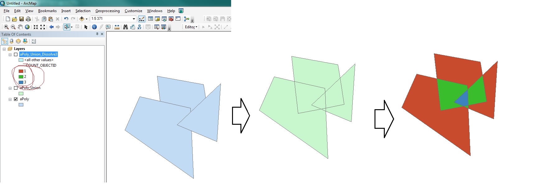
Your question is almost a duplicate of Counting and rasterizing polygon overlaps in ArcGIS Desktop? and is answered by step 1-2 in the answer to it:

  1. Union the polygons
  2. Add centroid coordinates to output, using Add Geometry Attributes
  3. Dissolve using CENTROID_X and CENTROID_Y as Dissolve fields and OBJECT ID field - COUNT and Statistics field

enter image description here

2
  • 1
    Maybe it's a dumb question, but that way I will just pick the Markets which has no other market in it's 1 mile vicinity. If I create a new buffer on these points, am I going to get the needed polygons? This is my task: "you should create a map that identifies areas (at the LSOA resolution if possible) that have less than 2 supermarkets (and convenience stores), in deprived areas (using the Index of Multiple Deprivation), and a low density of bus stops"
    – Rivyan
    Commented Jan 18, 2019 at 10:23
  • @Rivyan I have edited the answer
    – Bera
    Commented Jan 18, 2019 at 11:38

Your Answer

By clicking “Post Your Answer”, you agree to our terms of service and acknowledge you have read our privacy policy.

Not the answer you're looking for? Browse other questions tagged or ask your own question.