4

I get some GPS results which lay in China with WGS84 coordinate system, and I need to choose a projection to reproject for.

First I chooses the UTM projection, but I find the results lay in different UTM zone, and I find it difficult to choose a right zone.

Are there any projection that take meter for unit and match for the results?

2
  • 3
    What are you using the projection for? Mapping? Analysis? If the latter, what kind of analysis? The purpose matters, because many projections are suitable, but some are more suitable for some purposes than others.
    – whuber
    Commented Aug 31, 2012 at 12:48
  • Some general guidance for selecting a projection appears in a related thread at gis.stackexchange.com/questions/32115/….
    – whuber
    Commented Aug 31, 2012 at 23:07

3 Answers 3

4

It has been a while since you posted this but I was just answering some projection info on the site and this question jumped out to me. It is probably too late but maybe others will see the post and the only answer had only 1 negative vote.

Use http://spatialreference.org/ref/sr-org/7564/ (it is km so m is fine).

The multiple UTM zone answer is cumbersome (but will work if needed) as China has so many zones. This one projection will work across all of China and is Albers based.

It is good for area calculations.

1
  • +1 That's a reasonable choice. For large countries, looking at standard country-wide projections ought to be the first thing one considers. Most large countries have (at a minimum) an equal-area and a conformal projection specifically adapted to their extents.
    – whuber
    Commented Aug 4, 2013 at 15:21
-1

I'd select results in each UTM zone, and project each of them separately. Of course, it depends on the operations you want to perform, but typically you'll get OK results one UTM zone either side of the "proper" zone.

8
  • Thanks for your reply! Is that mean two point in different UTM zone, than I should reproject them in different zone? How about if I calculate the distance between them, distance of different zone should be right? And if one polyline cross different zone, and how to reproject? Thanks!
    – billycat
    Commented Aug 31, 2012 at 6:57
  • 1
    In this case, the best answer would be "don't reproject" - use a function that knows how to calculate distances in WGS84 lon/lat. What tool are you using? If you can't do that, then maybe you could use an extended zone extent (e.g. half the width of the adjacent zones). This would be easier if you told us exactly what you are trying to accomplish, and any constraints that you have.
    – BradHards
    Commented Aug 31, 2012 at 7:03
  • Thanks for you reply! I'm using .NET, with NetTopolygySuite, ProjNet. I'm trying to parse and calculate the relation during some geometries, e.g. the distance from a point to a polyline, but they in different UTM zone; and I also try to make a buffer with meter unit, and do the spatial operate, with WGS84, I can't calculate the accurate degree convert from meter. So, I'm trying to look for a global projection that use meter for unit.
    – billycat
    Commented Aug 31, 2012 at 7:50
  • 1
    Something like buffer (for a reasonable size buffer) is easy - just select the appropriate UTM zone, project to that UTM zone, and do the buffering in UTM units (metres). You know that anything outside the UTM zone won't be within the buffer anyway. I still think my original recommendation to partition the data sets into a UTM zone (or UTM zone plus a half UTM zone width on either side) will be the easiest way to handle it.
    – BradHards
    Commented Aug 31, 2012 at 10:24
  • 4
    For any region that is extensive east-west, UTM is near the bottom of any reasonable list of possible projections, due to the metric distortions that will occur or the inordinate amount of work needed to segment the region into separate UTM zones and then reassemble them. To see how not "OK" the results on either side of the zone can be, use the formulas at gis.stackexchange.com/a/31711 and consider that (a) China's latitudes extend from around 19 to 46 degrees and (b) it occupies nine UTM zones spanning about 50 degrees. That ensures almost 10% scale and 20% area distortion.
    – whuber
    Commented Aug 31, 2012 at 12:54
-1

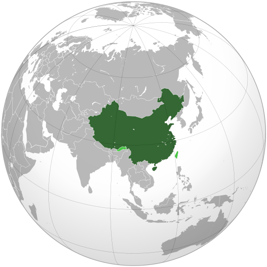
enter image description here

http://mapsof.net/china has thematic examples

http://en.wikipedia.org/wiki/Orthographic_projection_%28cartography%29

It is not a good projection for area calculations.

Your Answer

By clicking “Post Your Answer”, you agree to our terms of service and acknowledge you have read our privacy policy.

Not the answer you're looking for? Browse other questions tagged or ask your own question.