2

I am currently working on LiDAR point cloud road marking extraction.

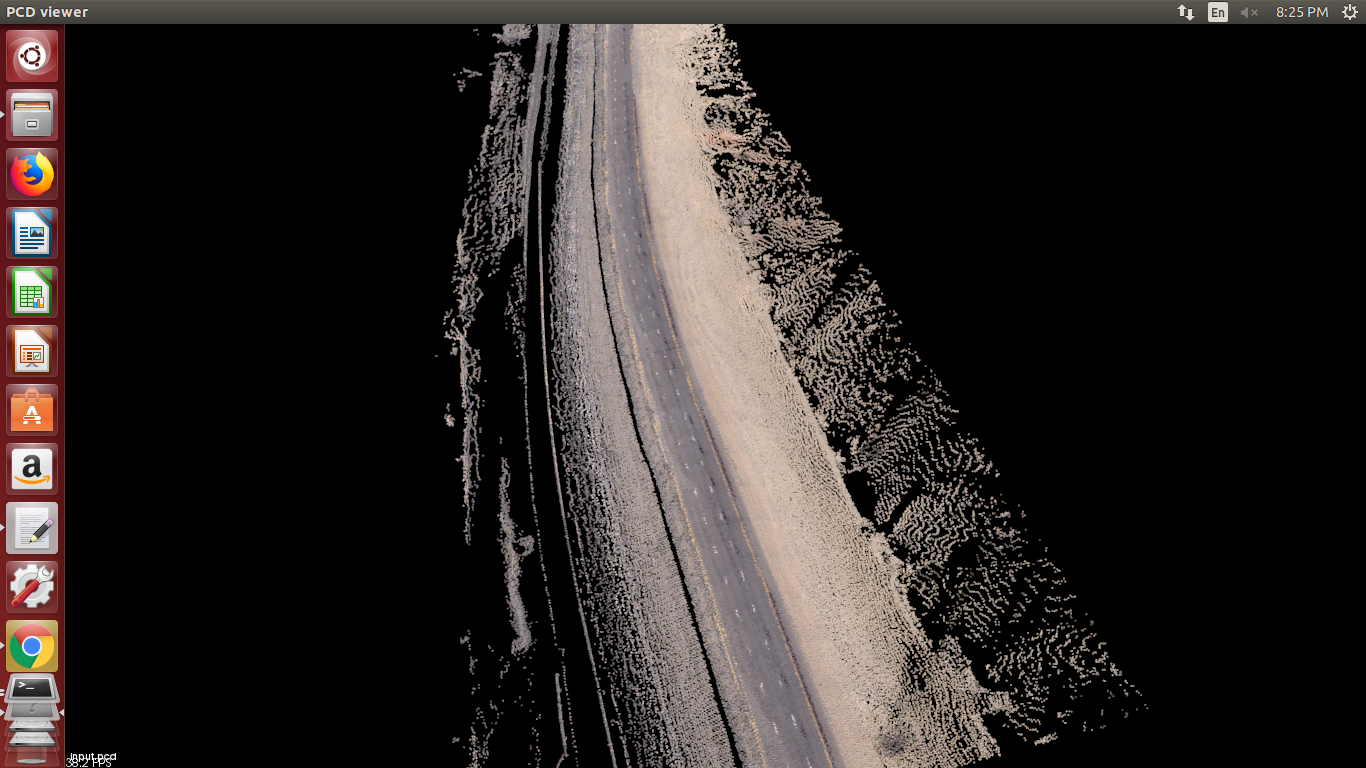
Please help me to get relevant public dataset in LAS format? Sample data is as shown in the image below: Data without original colour is also acceptable.

I am currently working on sample data provided by private organisation.

sample data

5
  • What part of the world are you interested in?
    – Stu Smith
    Commented Aug 6, 2019 at 18:47
  • 1
    If it’s open data that you seek then I think the place to ask is the Open Data Stack Exchange.
    – PolyGeo
    Commented Aug 6, 2019 at 19:59
  • I respectfully disagree with my esteemed colleague @PolyGeo: I believe the community does welcome Open Data questions. More details on meta GIS SE: gis.meta.stackexchange.com/q/4155/8104.
    – Aaron
    Commented Aug 7, 2019 at 3:05
  • @StuSmith I interested data with road markings, doesn't matter which part of world. Commented Aug 7, 2019 at 7:58
  • 1
    @PolyGeo Thanks, I was unaware about that. I will ask on open data. Commented Aug 7, 2019 at 8:00

2 Answers 2

2

I constructed a 24 billion point lidar point cloud web service available with color information that might be suitable for this task. It is available in Entwine Point Tile format on AWS courtesy of Bohannan Huston and the City of Hobbs, NM. You can view it in Potree at https://hobbslidar.com.

The EPT resource link is https://na-c.entwine.io/coh/ept.json. Find out how to use EPT with PDAL at readers.ept.

1
  • If you do use this resource, please make sure to credit the sponsors far and wide. It was challenging to convince them to release such a dataset, and seeing the impact of that release might convince others to do the same Commented Aug 7, 2019 at 2:25
2

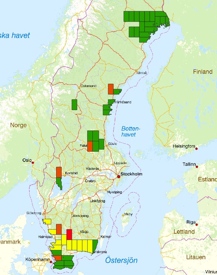
You can download data in LAZ-format which you can covert to las from Lantmäteriet (~The Swedish National Land Survey) from this link. Create account and download via ftp. The lidar data is in folder "Laserdata_Skog". Coverage as of 2019-08-07:

enter image description here

  • Green-ready to download
  • Yellow-quality Control in progress
  • Orange-scan finished
  • Red-scan in progress
3
  • thanks for reply, I gone through the Swedish National Land Survey data. It is forest data capered by terrestrial laser scanner , I want road data captured with mobile lidar scanner on vehicle. Commented Aug 7, 2019 at 7:48
  • Ok you should edit your question and clarify that this is the data you want
    – Bera
    Commented Aug 7, 2019 at 7:59
  • 1
    data shared by you is also helpful for me. I will use it for my next goal. Commented Aug 7, 2019 at 8:07

Your Answer

By clicking “Post Your Answer”, you agree to our terms of service and acknowledge you have read our privacy policy.

Not the answer you're looking for? Browse other questions tagged or ask your own question.