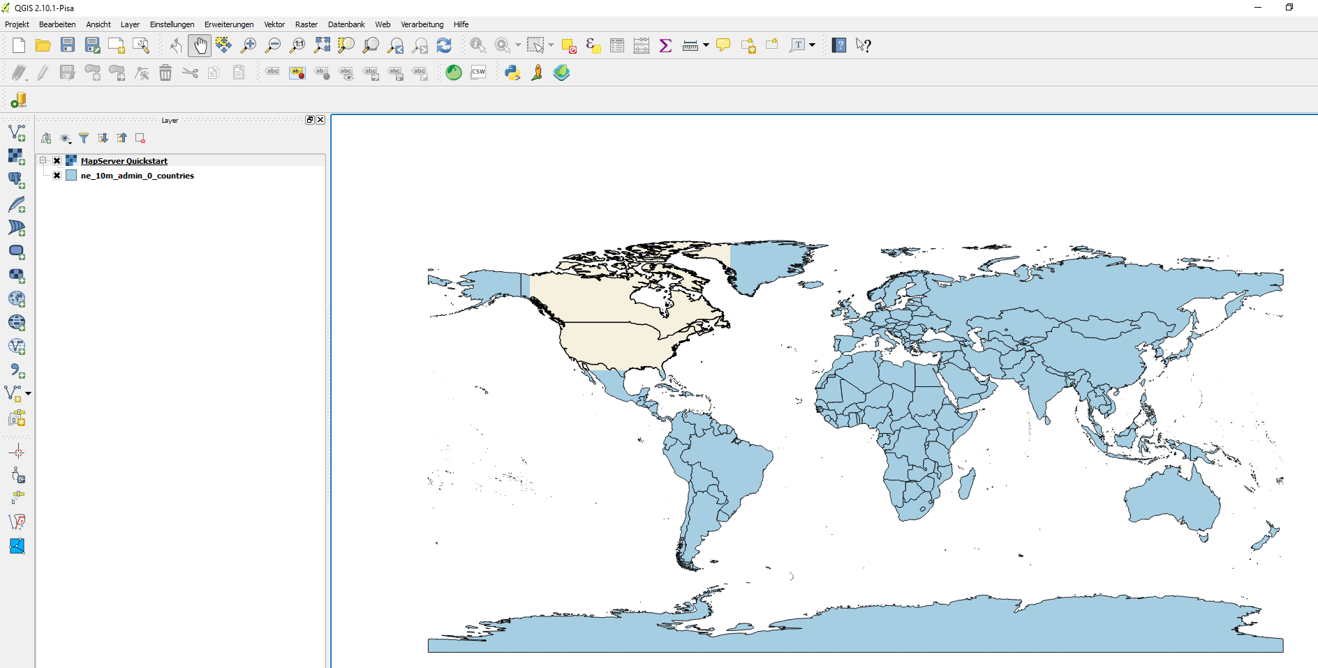
I have a problem with a MapServer configuration: test.map // It's installed under: C:\MS4W\ms4w\apps\mapserver_wms. The content of the test.map is follwing:
Map
  NAME "MAPSERVER_QUICKSTART"
  STATUS ON
  EXTENT -137 29 -53 88
  UNITS DD
  SHAPEPATH "data"
  #SIZE 800 600

  IMAGETYPE PNG24

  PROJECTION
    "init=epsg:4326"
  END

  WEB
    METADATA
      ows_title "MapServer Quickstart"
      ows_enable_request "*"
      ows_srs "EPSG:4326 EPSG:25832 EPSG:25833"
    END
  END

  LAYER
    NAME "Countries"
    STATUS ON
    TYPE POLYGON
    DATA "ne_10m_admin_0_countries"
    CLASS
      STYLE
        COLOR 246 241 223
        OUTLINECOLOR 0 0 0
      END
    END
  END

END
Now I would like to use this whole world map as a WMS Serice with the URL:
I put this WMS URL into QGIS and connect: This is working, but it show ONLY a small part of the whole area (world)! See the diffrence between blue and yellow (blue = imported the shape directly to QGIS // yellow = same shapes as WMS but only a part of the whole). How can I give out the whole world map in the WMS?

