I am working on ArcMap 10.5 for temperature interpolation. I am using IDW for interpolation. I need to compare the results with and without elevation data. However, I am unable to understand how to add elevation and temperature interpolation layer? Basically, I want an interpolated temperature raster that reflects elevation effect as well.
2 Answers
Elevation is major factor in air temperature pattern, for small study area it is better to a) derive regression equation Temperature(Elevation) which in theory should show 6 degrees drop per 1 km of elevation, b)apply it on elevation model and c) forget other two factors, i.e. latitude and longitude or interpolate residuals i.e. deviations from Temperature(Elevation) curve using x,y. Add it to 1st raster.
You can find specialized software that can handle temperature mapping for larger areas, but there is none in ArcGIS. Fortunately ArcGIS comes with scipy package and there are at least 2 methods available for interpolation in n dimensional space, where n can be greater than 2, but it requires coding.
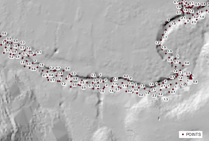
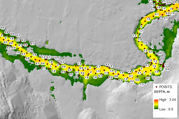
Third driver is of great importance in many other cases, e.g. flood mapping. Below example shows depth at sample points and depth raster derived using Radial Basis Function using x, y, z coordinates of points and elevation model:
So, invest in coding or available commercial software.
You can use Combine tool to combine the two rasters of temperature and elevation. The combine tool:
Combines multiple rasters so that a unique output value is assigned to each unique combination of input values.
Although in your case, maybe, you don't want to create a new raster with unique values for the combined rasters, but at least you can see both attributes of temperature and elevation together to check their values.
-
It means I need to combine elevation and temperature raster layer and then apply interpolation on "Combined" layer , for temperature?? Commented Oct 5, 2020 at 7:26
-
No. As far as I understood from you question, you already have an interpolated temperature raster, and an interpolated elevation raster. The combine tool combines the two interpolated rasters and produces a new raster that contains the attribute data of both rasters so that you can easily check the results of both interpolations. Now, if this is not what you need, then please provide more information on your question. Commented Oct 5, 2020 at 7:42
-
I want an interpolated temperature raster that reflects elevation as well Commented Oct 5, 2020 at 7:56
-
Usually temperature reflects the elevation implicitly. Cold temperature exists at high elevations, and high temperature exists at low elevations. Commented Oct 5, 2020 at 8:05
-
Yes you are right. But a lot of research papers suggest using elevation as covariate for interpolation. It is also required as my area of study has different elevation levels. Commented Oct 5, 2020 at 8:07


