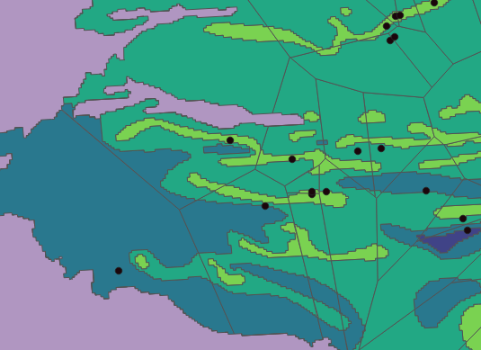
I am using QGIS for the first time.
I have a map of an aquifer with 2 different vector layers that split the aquifer differently into several polygons. In the first layer, I used some points(measuring stations) to create Voronoi polygons, in the other layer I got the polygons from vectorizing a Raster that has some land attributes, now I want to know how much area of each of the colorized layer fits into each of the Voronoi polygons.
For example, how much green, blue and light green are in each of the Thiessen polygons below?
I need to know for each one, not the total sum, because each Voronoi polygon has some different values that I will have to use later.


$areaof your smaller polygons, then either run statistics or copy & paste everything into excel, where you dissolve/sum by the ID.