2

I've got a question about changing the symbology of a certain rule-based layer. See below as to the current simple marker: Simple red marker
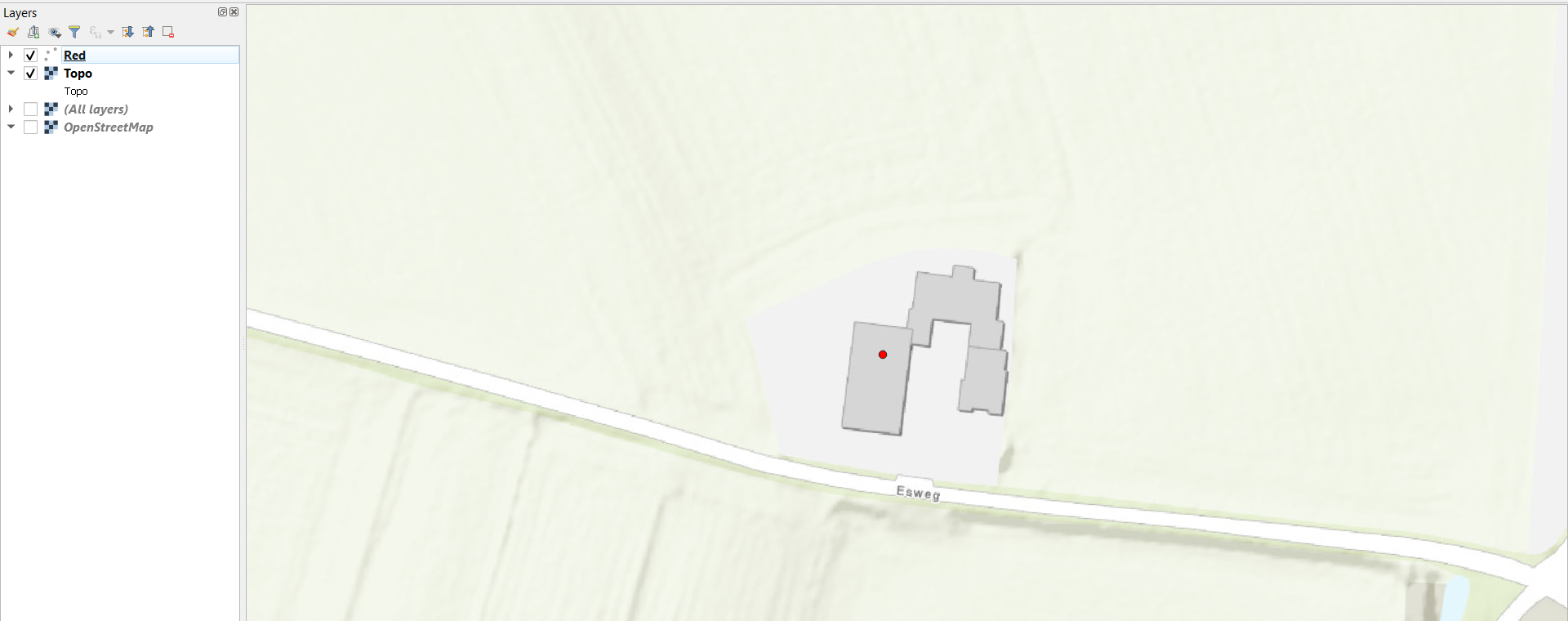
As you can see the house is given this grey color because of the added 'topo' vector layer. The question I have now is, is it possible for me to make the red marker into the vector: I want the whole building to be red. I tried the different symbology settings (raster image, vector field marker etc.) but no luck. It is also (in my understanding) not possible for the vector layer to be rule based because it does not contain the information to be filtered. Maybe combine the vector layer within the other layer that contains the rules?

I can answer the follow-up questions.

1
  • Although the vector layer does not contain any information to be filtered in its attribute table, it is possible the vector layer to be rule based using geometric properties of features (perimeter, area for polygons; length, azimuth for lines). Commented Jan 12, 2021 at 11:00

1 Answer 1

0

all layers except the "Red" layer are raster layers. so it is not possible to simply change the color of the building

7
  • Okay, so what would be the way this is possible? Is it possible for the vector layer to be integrated to the 'red' data source?
    – Jan
    Commented Jan 12, 2021 at 10:25
  • red is vector layer @Jan. You'd need the geometry information in order to display it.
    – Erik
    Commented Jan 12, 2021 at 10:31
  • Yeah so the geometry information I do have (lon, lat) from the red simple markers.
    – Jan
    Commented Jan 12, 2021 at 10:56
  • 1
    you'd need the geometry information of the whole building (all vertex points of that building), ergo a polygon. this polygon would be possible to color in whatever fashion you want. but as your building is only there in the raster layer, this is not possible. you would need to digitze the building manually into your vector(polygon)layer
    – sn1ks
    Commented Jan 12, 2021 at 12:17
  • 3
    if the spatial extend is "managable" (depends somewhat on your internet connection) you can try and download the building polygons from OSM (relatively easy with the QGIS plugin "QuickOSM") - then you would have the buildings as vector data and can style it the way you want
    – sn1ks
    Commented Jan 12, 2021 at 13:45

Your Answer

By clicking “Post Your Answer”, you agree to our terms of service and acknowledge you have read our privacy policy.

Not the answer you're looking for? Browse other questions tagged or ask your own question.