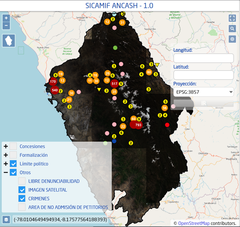
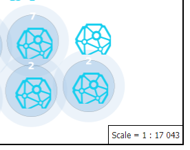
I got it decompile org.geotools.process.vector.PointStackerProcess from gt-process-feature-x.x.jar in webapps\geoserver\WEB-INF\lib and editing in the next way:
package org.geotools.process.vector;

import java.util.Collection;

import java.util.HashMap;
import java.util.HashSet;
import java.util.List;
import java.util.Map;
import java.util.Properties;
import java.util.Set;
import org.geotools.data.collection.ListFeatureCollection;
import org.geotools.data.simple.SimpleFeatureCollection;
import org.geotools.data.simple.SimpleFeatureIterator;
import org.geotools.feature.simple.SimpleFeatureBuilder;
import org.geotools.feature.simple.SimpleFeatureTypeBuilder;
import org.geotools.geometry.jts.ReferencedEnvelope;
import org.geotools.process.ProcessException;
import org.geotools.process.factory.DescribeParameter;
import org.geotools.process.factory.DescribeProcess;
import org.geotools.process.factory.DescribeResult;
import org.geotools.referencing.CRS;
import org.locationtech.jts.geom.Coordinate;
import org.locationtech.jts.geom.CoordinateSequenceFactory;
import org.locationtech.jts.geom.Envelope;
import org.locationtech.jts.geom.Geometry;
import org.locationtech.jts.geom.GeometryFactory;
import org.locationtech.jts.geom.Point;
import org.locationtech.jts.geom.Polygon;
import org.locationtech.jts.geom.impl.PackedCoordinateSequenceFactory;
import org.opengis.feature.Property;
import org.opengis.feature.simple.SimpleFeature;
import org.opengis.feature.simple.SimpleFeatureType;
import org.opengis.feature.type.AttributeDescriptor;
import org.opengis.referencing.FactoryException;
import org.opengis.referencing.crs.CoordinateReferenceSystem;
import org.opengis.referencing.operation.MathTransform;
import org.opengis.referencing.operation.TransformException;
import org.opengis.util.ProgressListener;

@DescribeProcess(title = "Point Stacker", description = "Aggregates a collection of points over a grid into one point per grid cell.")
public class PointStackerProcess implements VectorProcess {

    public static final String ATTR_GEOM = "geom";

    public static final String ATTR_COUNT = "count";

    public static final String ATTR_COUNT_UNIQUE = "countunique";

    public static final String ATTR_BOUNDING_BOX_GEOM = "geomBBOX";

    public static final String ATTR_BOUNDING_BOX = "envBBOX";

    public static final String ATTR_NORM_COUNT = "normCount";

    public static final String ATTR_NORM_COUNT_UNIQUE = "normCountUnique";

    public enum PreserveLocation {
        Single, Superimposed, Never;
    }

    @DescribeResult(name = "result", description = "Aggregated feature collection")
    public SimpleFeatureCollection execute(@DescribeParameter(name = "data", description = "Input feature collection") SimpleFeatureCollection data, @DescribeParameter(name = "cellSize", description = "Grid cell size to aggregate to, in pixels") Integer cellSize, @DescribeParameter(name = "weightClusterPosition", description = "Weight cluster position based on points added", defaultValue = "false") Boolean argWeightClusterPosition, @DescribeParameter(name = "normalize", description = "Indicates whether to add fields normalized to the range 0-1.", defaultValue = "false") Boolean argNormalize, @DescribeParameter(name = "preserveLocation", description = "Indicates wheter to preserve the original location of points for single/superimposed points", defaultValue = "Never", min = 0) PreserveLocation preserveLocation, @DescribeParameter(name = "outputBBOX", description = "Bounding box for target image extent") ReferencedEnvelope outputEnv, @DescribeParameter(name = "outputWidth", description = "Target image width in pixels", minValue = 1.0D) Integer outputWidth, @DescribeParameter(name = "outputHeight", description = "Target image height in pixels", minValue = 1.0D) Integer outputHeight, ProgressListener monitor) throws ProcessException, TransformException {
        CoordinateReferenceSystem srcCRS = ((SimpleFeatureType) data.getSchema()).getCoordinateReferenceSystem();
        CoordinateReferenceSystem dstCRS = outputEnv.getCoordinateReferenceSystem();
        MathTransform crsTransform = null;
        MathTransform invTransform = null;
        try {
            crsTransform = CRS.findMathTransform(srcCRS, dstCRS);
            invTransform = crsTransform.inverse();
        } catch (FactoryException e) {
            throw new ProcessException(e);
        }
        boolean normalize = false;
        if (argNormalize != null) {
            normalize = argNormalize.booleanValue();
        }
        boolean weightClusterPosition = false;
        if (argWeightClusterPosition != null) {
            weightClusterPosition = argWeightClusterPosition.booleanValue();
        }
        double cellSizeSrc = cellSize.intValue() * outputEnv.getWidth() / outputWidth.intValue();
        Collection<StackedPoint> stackedPts = stackPoints(data, crsTransform, cellSizeSrc, weightClusterPosition, outputEnv
                .getMinX(), outputEnv
                        .getMinY());
        SimpleFeatureType schema = null;
        for (StackedPoint sp : stackedPts) {
            schema = createType(srcCRS, normalize, sp.getFeature());
            break;
        }
        ListFeatureCollection result = new ListFeatureCollection(schema);
        SimpleFeatureBuilder fb = new SimpleFeatureBuilder(schema);
        GeometryFactory factory = new GeometryFactory((CoordinateSequenceFactory) new PackedCoordinateSequenceFactory());
        double[] srcPt = new double[2];
        double[] srcPt2 = new double[2];
        double[] dstPt = new double[2];
        double[] dstPt2 = new double[2];
        int maxCount = 0;
        int maxCountUnique = 0;
        if (normalize) {
            for (StackedPoint sp : stackedPts) {
                if (maxCount < sp.getCount()) {
                    maxCount = sp.getCount();
                }
                if (maxCountUnique < sp.getCount()) {
                    maxCountUnique = sp.getCountUnique();
                }
            }
        }

        for (StackedPoint sp : stackedPts) {
            Coordinate pt = getStackedPointLocation(preserveLocation, sp);
            srcPt[0] = pt.x;
            srcPt[1] = pt.y;
            invTransform.transform(srcPt, 0, dstPt, 0, 1);
            Coordinate psrc = new Coordinate(dstPt[0], dstPt[1]);
            Point point = factory.createPoint(psrc);
            fb.add(point);
            fb.add(Integer.valueOf(sp.getCount()));
            fb.add(Integer.valueOf(sp.getCountUnique()));
            Envelope boundingBox = sp.getBoundingBox();
            srcPt[0] = boundingBox.getMinX();
            srcPt[1] = boundingBox.getMinY();
            srcPt2[0] = boundingBox.getMaxX();
            srcPt2[1] = boundingBox.getMaxY();
            invTransform.transform(srcPt, 0, dstPt, 0, 1);
            invTransform.transform(srcPt2, 0, dstPt2, 0, 1);
            Envelope boundingBoxTransformed = new Envelope(dstPt[0], dstPt[1], dstPt2[0], dstPt2[1]);
            fb.add(boundingBoxTransformed);
            fb.add(boundingBoxTransformed.toString());

            if (normalize) {
                fb.add(Double.valueOf(sp.getCount() / maxCount));
                fb.add(Double.valueOf(sp.getCountUnique() / maxCountUnique));
            }
            if (sp.getCount() == 1) {
                //Here when count is we add the attribute value to the transformed featured
                SimpleFeature ref = sp.getFeature();
                for (AttributeDescriptor ad : ref.getType().getAttributeDescriptors()) {
                    fb.set(ad.getType().getName(), ref.getAttribute(ad.getType().getName()));
                }
            }
            result.add(fb.buildFeature(null));
        }
        return (SimpleFeatureCollection) result;
    }

    private Coordinate getStackedPointLocation(PreserveLocation preserveLocation, StackedPoint sp) {
        Coordinate pt = null;
        if (PreserveLocation.Single == preserveLocation) {
            if (sp.getCount() == 1) {
                pt = sp.getOriginalLocation();
            }
        } else if (PreserveLocation.Superimposed == preserveLocation
                && sp.getCountUnique() == 1) {
            pt = sp.getOriginalLocation();
        }
        if (pt == null) {
            pt = sp.getLocation();
        }
        return pt;
    }

    private Collection<StackedPoint> stackPoints(SimpleFeatureCollection data, MathTransform crsTransform, double cellSize, boolean weightClusterPosition, double minX, double minY) throws TransformException {
        SimpleFeatureIterator featureIt = data.features();
        Map<Coordinate, StackedPoint> stackedPts = new HashMap<>();
        double[] srcPt = new double[2];
        double[] dstPt = new double[2];
        Coordinate indexPt = new Coordinate();
        try {
            while (featureIt.hasNext()) {
                SimpleFeature feature = (SimpleFeature) featureIt.next();
                Geometry geom = (Geometry) feature.getDefaultGeometry();
                Coordinate p = getRepresentativePoint(geom);
                srcPt[0] = p.x;
                srcPt[1] = p.y;
                crsTransform.transform(srcPt, 0, dstPt, 0, 1);
                Coordinate pout = new Coordinate(dstPt[0], dstPt[1]);
                indexPt.x = pout.x;
                indexPt.y = pout.y;
                gridIndex(indexPt, cellSize);
                StackedPoint stkPt = stackedPts.get(indexPt);
                if (stkPt == null) {
                    double centreX = indexPt.x * cellSize + cellSize / 2.0D;
                    double centreY = indexPt.y * cellSize + cellSize / 2.0D;
                    stkPt = new StackedPoint(indexPt, new Coordinate(centreX, centreY));
                    stkPt.setFeature(feature);
                    stackedPts.put(stkPt.getKey(), stkPt);
                }
                stkPt.add(pout, weightClusterPosition);
            }
        } finally {
            featureIt.close();
        }
        return stackedPts.values();
    }

    private static Coordinate getRepresentativePoint(Geometry g) {
        if (g.getNumPoints() == 1) {
            return g.getCoordinate();
        }
        return g.getCentroid().getCoordinate();
    }

    private void gridIndex(Coordinate griddedPt, double cellSize) {
        long ix = (long) (griddedPt.x / cellSize);
        long iy = (long) (griddedPt.y / cellSize);
        griddedPt.x = ix;
        griddedPt.y = iy;
    }

    private SimpleFeatureType createType(CoordinateReferenceSystem crs, boolean stretch, SimpleFeature ref) {
        SimpleFeatureTypeBuilder tb = new SimpleFeatureTypeBuilder();
        tb.add("geom", Point.class, crs);
        tb.add("count", Integer.class);
        tb.add("countunique", Integer.class);
        tb.add("geomBBOX", Polygon.class);
        tb.add("envBBOX", String.class);
        if (stretch) {
            tb.add("normCount", Double.class);
            tb.add("normCountUnique", Double.class);
        }
        //Here we add the attributes from the original feature
        if (ref != null) {
            for (AttributeDescriptor ad : ref.getType().getAttributeDescriptors()) {
                tb.add(ad);
            }
        }
        tb.setName("stackedPoint");
        SimpleFeatureType sfType = tb.buildFeatureType();
        return sfType;
    }

    private static class StackedPoint {


        //Here is where i save the last feature before transformation;
        private SimpleFeature feature;

        private Coordinate key;

        private Coordinate centerPt;

        private Coordinate location = null;

        private int count = 0;

        private Set<Coordinate> uniquePts;

        private Envelope boundingBox = null;

        public SimpleFeature getFeature() {
            return feature;
        }

        public void setFeature(SimpleFeature feature) {
            this.feature = feature;
        }

        public StackedPoint(Coordinate key, Coordinate centerPt) {
            this.key = new Coordinate(key);
            this.centerPt = centerPt;
        }

        public Coordinate getKey() {
            return this.key;
        }

        public Coordinate getLocation() {
            return this.location;
        }

        public int getCount() {
            return this.count;
        }

        public int getCountUnique() {
            if (this.uniquePts == null) {
                return 1;
            }
            return this.uniquePts.size();
        }

        public Envelope getBoundingBox() {
            return this.boundingBox;
        }

        public void add(Coordinate pt) {
            add(pt, false);
        }

        public void add(Coordinate pt, boolean weightClusterPosition) {
            this.count++;
            if (this.uniquePts == null) {
                this.uniquePts = new HashSet<>();
            }
            this.uniquePts.add(pt);
            if (weightClusterPosition) {
                pickWeightedLocation(pt);
            } else {
                pickNearestLocation(pt);
            }
            if (this.boundingBox == null) {
                this.boundingBox = new Envelope();
            } else {
                this.boundingBox.expandToInclude(pt);
            }
        }

        public Coordinate getOriginalLocation() {
            if (this.uniquePts != null && this.uniquePts.size() == 1) {
                return this.uniquePts.iterator().next();
            }
            return null;
        }

        private void pickWeightedLocation(Coordinate pt) {
            if (this.location == null) {
                this.location = pt;
                return;
            }
            this.location = average(this.location, pt);
        }

        private void pickNearestLocation(Coordinate pt) {
            if (this.location == null) {
                this.location = average(this.centerPt, pt);
                return;
            }
            if (pt.distance(this.centerPt) < this.location.distance(this.centerPt)) {
                this.location = average(this.centerPt, pt);
            }
        }

        private void pickCenterLocation(Coordinate pt) {
            if (this.location == null) {
                this.location = new Coordinate(pt);
                return;
            }
            this.location = this.centerPt;
        }

        private static Coordinate average(Coordinate p1, Coordinate p2) {
            double x = (p1.x + p2.x) / 2.0D;
            double y = (p1.y + p2.y) / 2.0D;
            return new Coordinate(x, y);
        }
    }
}
Then compile it again, replace in the jar file and start GeosServer


