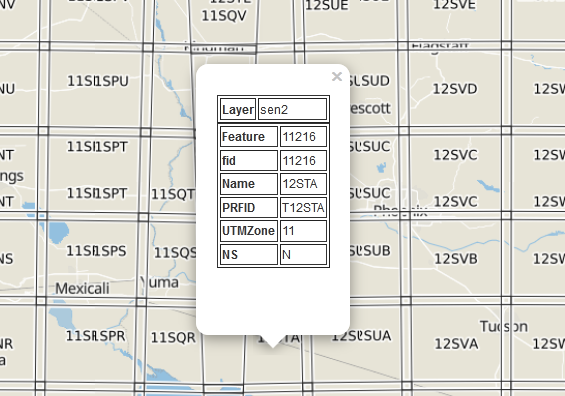
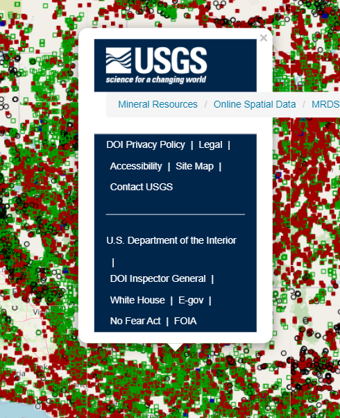
I have a HTML/Leaflet page utilising BetterWMS script below. The script returns GetFeatureInfo over WMS layer. Unfortunately it is not working with WMSs published by Qgis Server and MapServer, although ArcGIS Server and GeoServer services work fine. Below, you can find example services published by QGIS/MapServer.
QGIS Server Service:
https://ows.geo.hu-berlin.de/cgi-bin/qgis_mapserv.fcgi?request=GetCapabilities&service=WMS
layer: sen2
MapServer Service:
https://demo.mapserver.org/cgi-bin/wms?request=GetCapabilities&service=WMS
layer: cities
Any tips about how to fix the script so as to use with these services as well?
L.TileLayer.BetterWMS = L.TileLayer.WMS.extend({

  onAdd: function (map) {
    // Triggered when the layer is added to a map.
    //   Register a click listener, then do all the upstream WMS things
    L.TileLayer.WMS.prototype.onAdd.call(this, map);
    map.on('click', this.getFeatureInfo, this);
  },

  onRemove: function (map) {
    // Triggered when the layer is removed from a map.
    //   Unregister a click listener, then do all the upstream WMS things
    L.TileLayer.WMS.prototype.onRemove.call(this, map);
    map.off('click', this.getFeatureInfo, this);
  },

  getFeatureInfo: function (evt) {
    // Make an AJAX request to the server and hope for the best
    var url = this.getFeatureInfoUrl(evt.latlng),
      showResults = L.Util.bind(this.showGetFeatureInfo, this);
    $.ajax({
      url: url,
      success: function (data, status, xhr) {
        var err = typeof data === 'string' ? null : data;
        //Fix for blank popup window
        var doc = (new DOMParser()).parseFromString(data, "text/html");
        if (doc.body.innerHTML.trim().length > 0)
          showResults(err, evt.latlng, data);
      },
      error: function (xhr, status, error) {
        showResults(error);
      }
    });
  },

  getFeatureInfoUrl: function (latlng) {
    // Construct a GetFeatureInfo request URL given a point
    var point = this._map.latLngToContainerPoint(latlng, this._map.getZoom()),
        size = this._map.getSize(),

        params = {
          request: 'GetFeatureInfo',
          service: 'WMS',
          srs: 'EPSG:4326',
          styles: this.wmsParams.styles,
          transparent: this.wmsParams.transparent,
          version: this.wmsParams.version,
          format: this.wmsParams.format,
          bbox: this._map.getBounds().toBBoxString(),
          height: size.y,
          width: size.x,
          layers: this.wmsParams.layers,
          query_layers: this.wmsParams.layers,
          info_format: 'text/html'
        };

    params[params.version === '1.3.0' ? 'i' : 'x'] = point.x;
    params[params.version === '1.3.0' ? 'j' : 'y'] = point.y;

    return this._url + L.Util.getParamString(params, this._url, true);
  },

  showGetFeatureInfo: function (err, latlng, content) {
    if (err) { console.log(err); return; } // do nothing if there's an error

    // Otherwise show the content in a popup, or something.
    L.popup({ maxWidth: 800, minWidth: 0, autoPan: false })
      .setLatLng(latlng)
      .setContent(content)
      .openOn(this._map);
  }
});

L.tileLayer.betterWms = function (url, options) {
  return new L.TileLayer.BetterWMS(url, options);
};
Here is my full html file including scripts and WMSs (all queryable):
<!DOCTYPE html>
<html>
<head>
<title>Layers Control Tutorial - Leaflet</title>
<meta charset="utf-8" />
<meta name="viewport" content="width=device-width, initial-scale=1.0">
<link rel="shortcut icon" type="image/x-icon" href="docs/images/favicon.ico" />
<link rel="stylesheet" href="https://unpkg.com/[email protected]/dist/leaflet.css" integrity="sha512-xodZBNTC5n17Xt2atTPuE1HxjVMSvLVW9ocqUKLsCC5CXdbqCmblAshOMAS6/keqq/sMZMZ19scR4PsZChSR7A==" crossorigin=""/>
<script src="https://unpkg.com/[email protected]/dist/leaflet.js" integrity="sha512-XQoYMqMTK8LvdxXYG3nZ448hOEQiglfqkJs1NOQV44cWnUrBc8PkAOcXy20w0vlaXaVUearIOBhiXZ5V3ynxwA==" crossorigin=""></script>
<script src="https://ajax.googleapis.com/ajax/libs/jquery/1.10.1/jquery.min.js"></script>
<style>
html, body {
height: 100%;
margin: 0;
}
#map {
width: 1200px;
height: 800px;
}
</style>
</head>
<body>
<div id='map'></div>
<script>
// BetterWMS (https://gist.github.com/rclark/6908938)
L.TileLayer.BetterWMS = L.TileLayer.WMS.extend({
onAdd: function (map) {
// Triggered when the layer is added to a map.
// Register a click listener, then do all the upstream WMS things
L.TileLayer.WMS.prototype.onAdd.call(this, map);
map.on('click', this.getFeatureInfo, this);
},
onRemove: function (map) {
// Triggered when the layer is removed from a map.
// Unregister a click listener, then do all the upstream WMS things
L.TileLayer.WMS.prototype.onRemove.call(this, map);
map.off('click', this.getFeatureInfo, this);
},
getFeatureInfo: function (evt) {
// Make an AJAX request to the server and hope for the best
var url = this.getFeatureInfoUrl(evt.latlng),
showResults = L.Util.bind(this.showGetFeatureInfo, this);
$.ajax({
url: url,
success: function (data, status, xhr) {
var err = typeof data === 'string' ? null : data;
//Fix for blank popup window
var doc = (new DOMParser()).parseFromString(data, "text/html");
if (doc.body.innerHTML.trim().length > 0)
showResults(err, evt.latlng, data);
},
error: function (xhr, status, error) {
showResults(error);
}
});
},
getFeatureInfoUrl: function (latlng) {
// Construct a GetFeatureInfo request URL given a point
var point = this._map.latLngToContainerPoint(latlng, this._map.getZoom()),
size = this._map.getSize(),
params = {
request: 'GetFeatureInfo',
service: 'WMS',
srs: 'EPSG:4326',
styles: this.wmsParams.styles,
transparent: this.wmsParams.transparent,
version: this.wmsParams.version,
format: this.wmsParams.format,
bbox: this._map.getBounds().toBBoxString(),
height: size.y,
width: size.x,
layers: this.wmsParams.layers,
query_layers: this.wmsParams.layers,
info_format: 'text/html'
};
params[params.version === '1.3.0' ? 'i' : 'x'] = point.x;
params[params.version === '1.3.0' ? 'j' : 'y'] = point.y;
return this._url + L.Util.getParamString(params, this._url, true);
},
showGetFeatureInfo: function (err, latlng, content) {
if (err) { console.log(err); return; } // do nothing if there's an error
// Otherwise show the content in a popup, or something.
L.popup({ maxWidth: 800, minWidth: 0, autoPan: false })
.setLatLng(latlng)
.setContent(content)
.openOn(this._map);
}
});
L.tileLayer.betterWms = function (url, options) {
return new L.TileLayer.BetterWMS(url, options);
};
// BetterWMS
var mbAttr = 'Map data © <a href="https://www.openstreetmap.org/copyright">OpenStreetMap</a> contributors, ' +
'Imagery © <a href="https://www.mapbox.com/">Mapbox</a>',
mbUrl = 'https://api.mapbox.com/styles/v1/{id}/tiles/{z}/{x}/{y}?access_token=pk.eyJ1IjoibWFwYm94IiwiYSI6ImNpejY4NXVycTA2emYycXBndHRqcmZ3N3gifQ.rJcFIG214AriISLbB6B5aw';
var grayscale = L.tileLayer(mbUrl, {id: 'mapbox/light-v9', tileSize: 512, zoomOffset: -1, attribution: mbAttr}),
streets = L.tileLayer(mbUrl, {id: 'mapbox/streets-v11', tileSize: 512, zoomOffset: -1, attribution: mbAttr});
var arcgis = L.tileLayer.betterWms('https://nowcoast.noaa.gov/arcgis/services/nowcoast/forecast_meteoceanhydro_pts_zones_geolinks/MapServer/WMSServer',{
maxZoom: 21, format: 'image/png', layers: '1', transparent: true});
var geoserver = L.tileLayer.betterWms('https://www.mrlc.gov/geoserver/mrlc_display/NLCD_2016_Land_Cover_L48/wms',{
maxZoom: 21, format: 'image/png', layers: 'NLCD_2016_Land_Cover_L48', transparent: true});
var qgis = L.tileLayer.betterWms('https://ows.geo.hu-berlin.de/cgi-bin/qgis_mapserv.fcgi',{
maxZoom: 21, format: 'image/png', layers: 'sen2', transparent: true});
var mapserver = L.tileLayer.betterWms('https://demo.mapserver.org/cgi-bin/wms',{
maxZoom: 21, format: 'image/png', layers: 'cities', transparent: true});
var map = L.map('map', {
center: [40, -98],
zoom: 5,
layers: [grayscale]
});
var baseLayers = {
"Grayscale": grayscale,
"Streets": streets,
};
var overlays = {
"Arcgis Server": arcgis,
"Geoserver": geoserver,
"Qgis Server": qgis,
"MapServer": mapserver,
};
L.control.layers(baseLayers, overlays, { collapsed: false }).addTo(map);
</script>
</body>
</html>


