2

Australian bushwalkers offer map coordinates in the GDA94-56 format (essentially identical to WGS84). When I am working on topo maps in QGIS, it would be fantastic to quickly locate a coordinate within the map that is listed in this format (e.g. GDA462568).

Is QGIS capable of displaying coordinates continuously as the cursor moves?

If not, what is the most efficient way to input coordinates as waypoints?

1 Answer 1

5

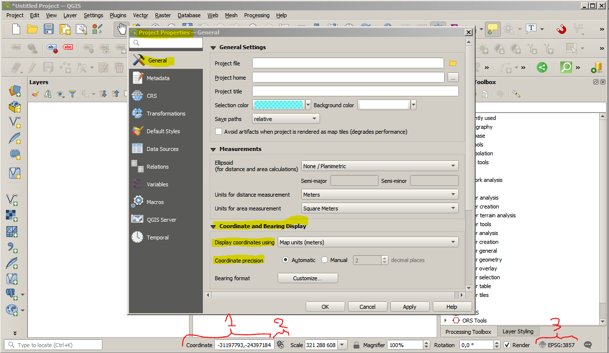
QGIS display the coordinate of your map cursor at the bottom (see n°1 on below picture), by clicking on the symbol next to it (n°2) you may alternate between coordinate display and extents display.

You have some control on how these information are displayed by accessing the General tab in the project properties window (go to "Project" > "Properties..." or click on n°3)

enter image description here

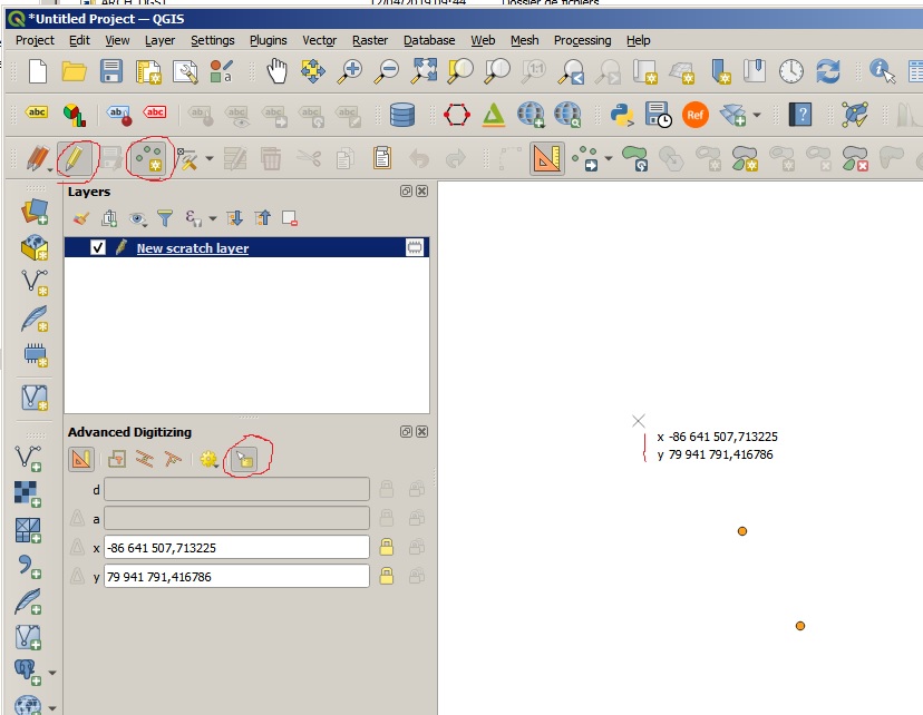
Also as it seem that GDA94-56 is a projected CRS you could open the Advanced Digitizing panel and toggle Floater (this only work in an edit session) that will display coordinate next to the Add feature tool cursor. this panel also let you to directly input coordinate.

enter image description here

0

Your Answer

By clicking “Post Your Answer”, you agree to our terms of service and acknowledge you have read our privacy policy.

Not the answer you're looking for? Browse other questions tagged or ask your own question.