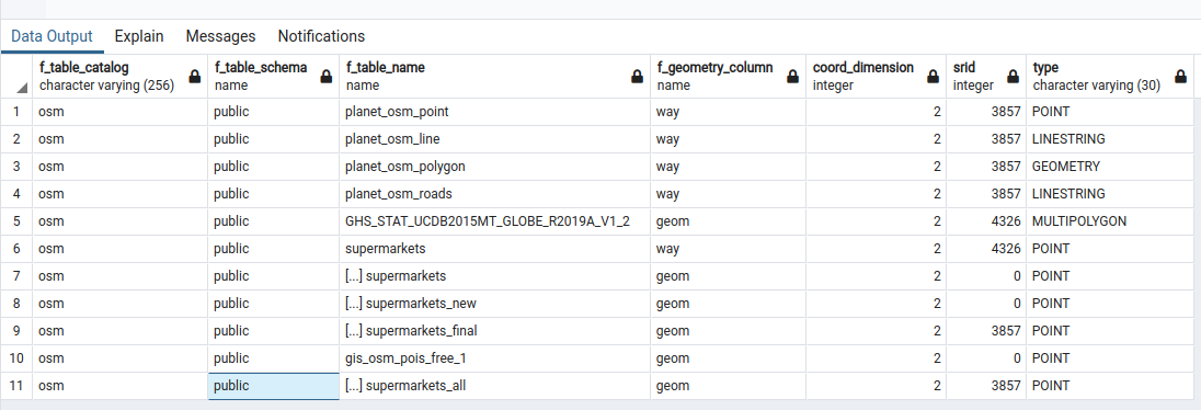
I've just loaded a bunch of shapefiles into postgis using psql2shp (from the command line). All of the shapefiles appeared to have been inserted correctly and the table I created is populated. But the points are projected in the wrong location. I specified the SRID when I imported them using the -s switch in psql:
for i in $(find . -type f -name "*.shp"); do shp2pgsql -I -s 3857 -a $i \ supermarkets_all | psql --cluster 12/main osm; done;
If I now check the SRID using Find_SRID() I get an error:
"ERROR: find_srid() - could not find the corresponding SRID - is the geometry registered in the GEOMETRY_COLUMNS table? Is there an uppercase/lowercase mismatch?
CONTEXT: PL/pgSQL function find_srid(character varying,character varying,character varying) line 17 at RAISE
SQL state: P0001"
I've also checked that the geometry_columns view contains my geometry column - which it does. However, the table that it relates to is preceded by square brackets - I'm not sure if this is relevant? 
Is there anyway to fix the geometry - or do I just need to re-import all of the data and try again?
