2

Problem:

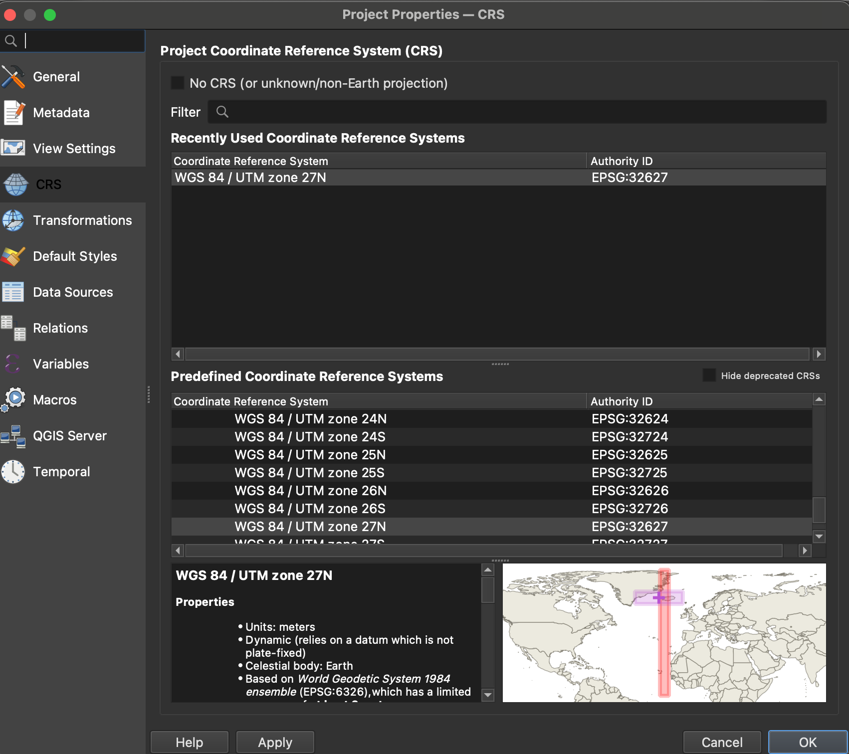
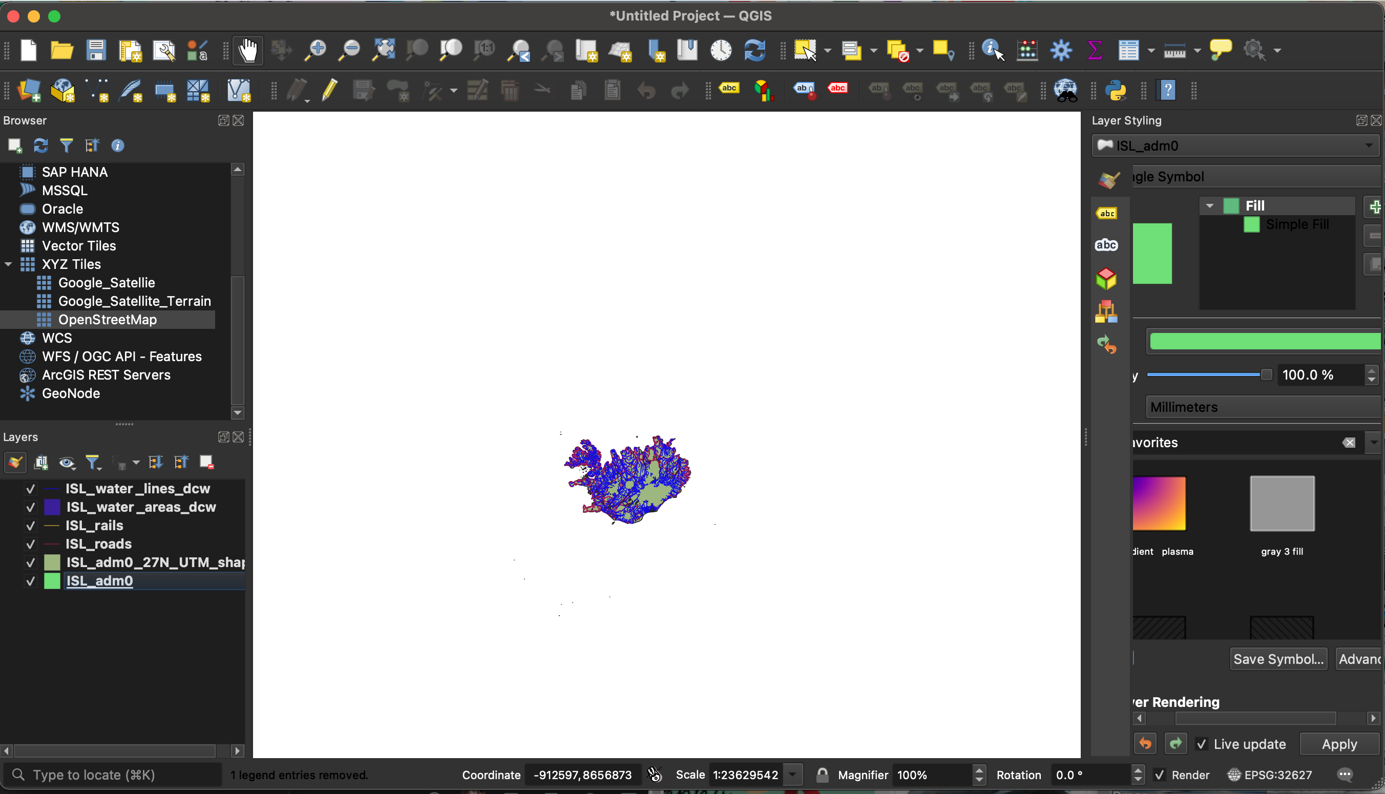
Firstly, I am a complete novice to QGIS and I have only been using this software for one week. Therefore, I apologise if I am not using the correct terminology. I have added vector layers (ESRI shapefiles) for the country of Iceland showing railroads, water bodies, and roads. The coordinate reference system (CRS) for my vector data is WGS 84/UTM zone 27 N (see images 1 and 2).

I am a student and my tutor is not available to provide help for another few weeks and I have deadlines. I have to add two XYZ tiles: (1) an 'Open Street Map' and (2) a 'Google Satellite' image that I downloaded from Hatari labs (see line below). The idea is to insert an XYZ tile into my workspace to show Iceland in context to Greenland and the UK.

Hatari Lab link:

Location of Google Satellite Image

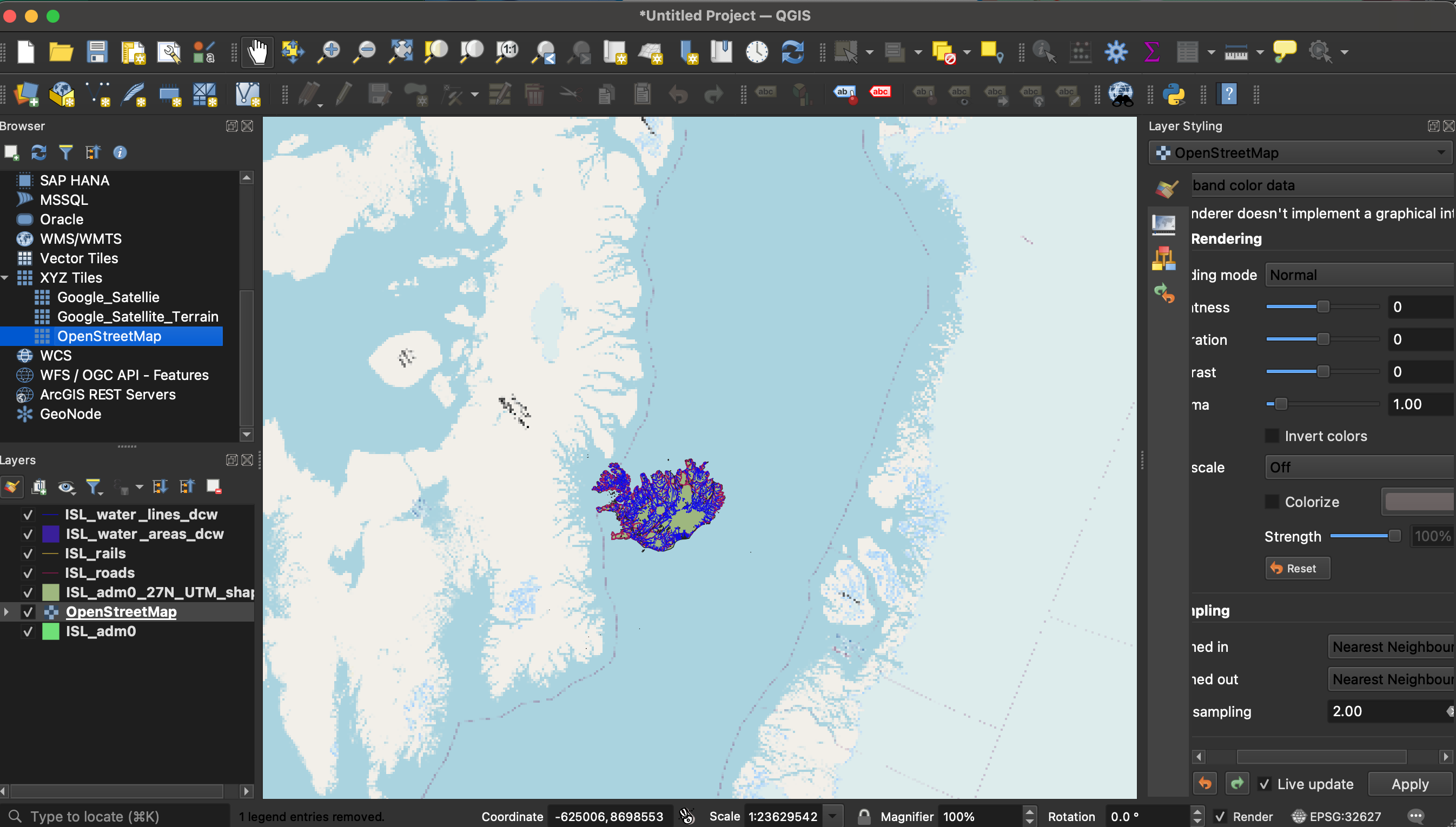
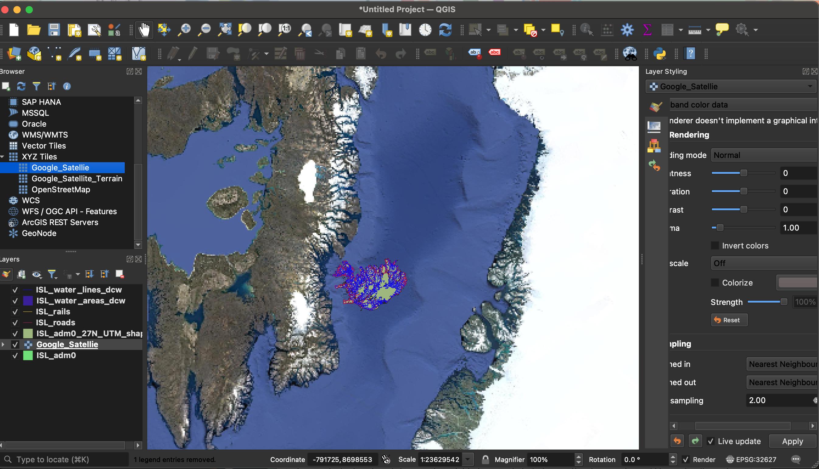
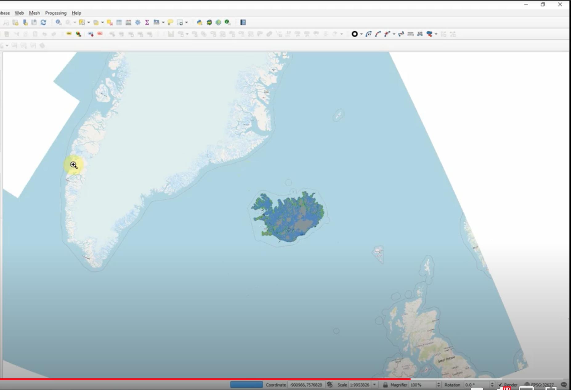
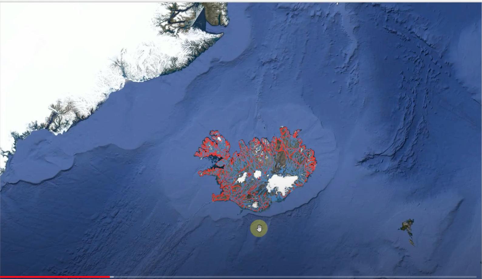
When I add either XYZ tile to my workspace, the resolution and scale are acting really strange (see images 3 and 4). The final result is supposed to look like images 5 and 6.

In the tutorial, when the XYZ tiles download, the vector data is positioned exactly on top of Iceland to the correct scale, and you can also see Iceland in context to Greenland and the UK. However, when I add my XYZ tiles, my vector data is not on top of Iceland. Instead, these XYZ tiles are located right next to Greenland, which is not where Iceland is realistically located.

How I have tried to solve the issue?

As I mentioned beforehand, my tutor is not available right now to advise, although, he sent me an email suggesting that this is a CRS issue. I have tried changing the CRS for both XYZ tiles to WGS 84/UTM zone 27 N to be identical to my vector data and it did not work. In my tutorials, the CRS for both of these XYZ tiles are EPSG:3857 - WGS 84/Pseudo-Mercator, and my tutor did not change their CRS's. I don't know how to correct this issue and I have been trying for two days to no avail.

Would anyone know how to help me fix this issue?

I'm very confused!

Image 1:

enter image description here

Image 2

enter image description here

Image 3

enter image description here

Image 4

enter image description here

Image 5

enter image description here

Image 6

enter image description here

1
  • 1
    Welcome to gis.stackexchange and congrats on the very complete question! Commented Feb 24, 2022 at 13:39

1 Answer 1

1

I agree this seems to be a (simple) CRS mismatching problem:

  • Google maps (XYZ tiles) are natively in EPSG:3857 WGS 84 - Pseudo Mercator
  • your shapefile data's CRS seems to be EPSG:32627 - WGS 84/UTM zone 27 N

QGIS takes care to reproject on the fly different datasets onto the Project CRS, at least as long as the information it has about the original CRS of each layer is correct.

I would therefore suggest to:

  • set the Project CRS to the same as Google Maps, and
  • correct the CRS setting of the shapefile

To do so, I would reccomend to:

  1. righ-click on GoogleMaps layer in the Layers swatch, then Layer CRS -> Set Layer CRS, then select EPSG:3857
  2. righ-click on shapefile layer in the Layers swatch, then Layer CRS -> Set Layer CRS, then select EPSG:32627
  3. righ-click on GoogleMaps layer in the Layers swatch again, then Layer CRS -> Set Project CRS From Layer.

you sohuld end up with your Project being in EPSG:3857 (Pseduo Mercator), and the shapefile corectly reprojected onto Google Map's backdrop.

If it is not like that, as a fallback, try starting a new project from scratch, and/or request again to be provided with the actual CRS of the shapefile layer.

By the way, the reason why I suggest to set the Project's CRS like Google Map's CRS is because reprojecting the vector shapefile is computationally much easier for QGIS than reprojecting all Google Maps pixel into another CRS. However, once the two datasets are aligned, you can of course change the Project's CRS to anything you want, and both layers will be happily reprojected.

5
  • 1
    RafDouglas, I am so grateful for your suggestion, and many thanks for answering my question. I have still not been able to overlay both layers for the vector data and the 'Google Satellite' image to align, I am still trying. Do you have any suggestions? Many thanks if you can help Commented Mar 1, 2022 at 4:52
  • Do you have the chance to share the project, inlcuding the layers (for example on a Google Drive)? Commented Mar 2, 2022 at 11:14
  • 1
    Yes! That is possible as the project files are open source. How can I share them with you? Commented Mar 4, 2022 at 4:41
  • maybe upload them on a shared folder on GoogleDrive / Dropbox Commented Mar 4, 2022 at 7:42
  • 1
    I ended up downloading the software again and the XYZ street tiles are working now. I think the version that I was using had bugs in the system. I am not an expert; however, I feel really happy the issue has been solved. Thank you for your suggestions. Commented Mar 31, 2022 at 2:46

Your Answer

By clicking “Post Your Answer”, you agree to our terms of service and acknowledge you have read our privacy policy.

Not the answer you're looking for? Browse other questions tagged or ask your own question.